Here goes our third hike in the Dolomites — the trail to Lake Sorapis. As it turned out, it was the most underrated of all five that we did when it came to difficulty.
The Dolomites are known as the Pale Mountains. However, depending on the time of day, the landscape shifts from cold whites and greys to warmer shades of yellow, green, pink, and orange.
Blue, though, is not a color you normally associate with the Dolomites — until you hike to Lake Sorapis. Its milky cyan-blue water feels almost unreal against the grey rock and snow-dusted peaks.
Many travelers severely underestimate the hike to this lake, which is why I created the guide to hiking Lake Sorapis in 2026. I will cover the ways to get here, give you essential tips on the trail conditions, and present you with a play-by-play trekking experience.
Article contents
- How to get to Lago di Sorapis?
- Where to park?
- Overview of the hike to Lake Sorapis
- Best time to hike to the lake
- Additional tips about the Dolomites
- Car rental in the Dolomites
- Where to stay in the Dolomites?
- What are the other hikes we did in the Dolomites?
How to get to Lago di Sorapis?
There’s no other way to get to the lake except by hiking.
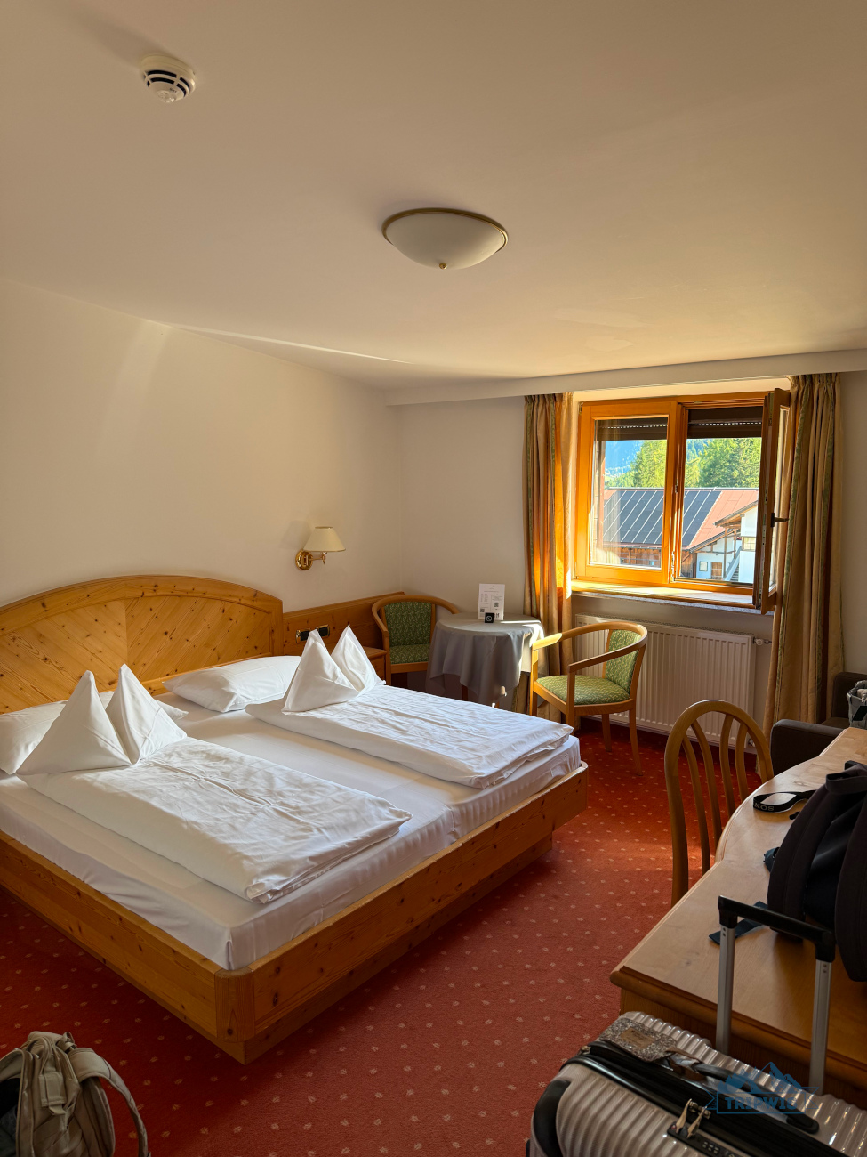
Our latest Dolomites itinerary was a packed one, so I had to think about staying in a place that offered prime access to a couple natural sites at the same time. For exploring Lake Sorapis, I decided to take up residence in a mountain village of San Vito di Cadore, namely in an Alpine-style 3* Best Western Hotel Nevada (from €100 per night) as the hotel prices in Cortina d’Ampezzo shocked me. It was a 25-minute drive from our hotel to the trailhead.
Before the particular info you need to know to hike to Lago di Sorapis (Lake Sorapis), I have to give you a simple warning on the names in the region. Apart from the German and Italian versions, some attractions have distinct Ladin monikers. Ladin is an old language spoken by a minority of people in the Dolomites.
Here are the places and names for them that you will have to know to better navigate around the area:
- Lake Sorapis (Lago di Sorapis / Sorapissee) — the star of the show with the curious name etymology. The lake’s water flows into a hidden waterfall (Pis is waterfall in Ladin, and Sora means above). So, the name of the lake literally means Sora el Pis, or Above the waterfall.
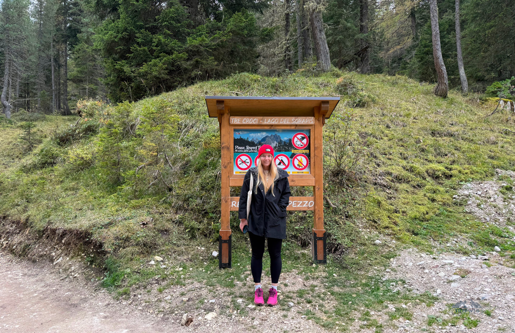
- Passo Tre Croci (Der Passo Tre Croci) — a mountain pass where a trailhead to Lake Sorapis starts.
- Cortina d’Ampezzo (Anpezo) — a charming Nutcracker-like town that is considered to be the best base for exploring the Veneto region. Also known as the Queen of the Dolomites (due to its natural setting in the valley surrounded by a ring of mountains that most resembles a crown), Cortina is now the second-time host of the Winter Olympics (1956 and 2026).
- Veneto region — our previous escapades focused on South Tyrol locations (Alpe di Siusi and Seceda), but Lake Sorapis is not in South Tyrol. It is set in the province of Belluno within the Veneto region (the one with Venice as its capital).
Now, back to your regularly scheduled programming. Your hike to Lake Sorapis will begin at Passo Tre Croci, which is a starting point of many trails.
There are three ways to get to the Lago di Sorapis trailhead:
- By car: Take the SR48 road from Cortina d’Ampezzo towards Tre Cime di Lavaredo; you will reach Passo Tre Croci in about 10 kilometers.
- By bus: Take the Dolomiti Bus line 30/31 from Cortina d’Ampezzo’s bus station towards Lake Misurina, but get off early at Passo Tre Croci. It’s a seasonal summer service — you should check the schedule beforehand on the official website. Do not plan on doing a late afternoon hike to Lake Sorapis if you came to the trailhead by bus — you will be stranded here, since the line doesn’t really operate past 7 p.m.
- By foot: The ultimate cheat code! Simply stay at 3* B&B HOTEL Passo Tre Croci Cortina, which is set MINUTES away from the trailhead. You could roll out of bed and onto the trail to hike to Lake Sorapis in no time. It’s also a 20-minute drive to Tre Cime di Lavaredo — perfect location for covering the two exciting hikes in the area. If you need to quickly “run into town”, Cortina is just a 15-minute drive away.
Where to park to hike to Lake Sorapis?

Parking at the Lake Sorapis trailhead is very straightforward, with two main options to consider:
— Along the road near the trailhead where the cars are neatly lined up on the shoulder. The roadside parking fills up extremely fast; at 1 p.m. in October we found only one free spot.
— Parcheggio per Sorapis — a bigger lot set downhill; to find it, you have to retrace your steps a little on the SR48 road back to Cortina d’Ampezzo. It’s a 10-minute walk from the car park to the trailhead (550 meters).
No matter which of the two parking options you choose, you will not pay a dime for leaving your car here — parking is free. However, you have to arrive very early (before 8 a.m. ideally) to snag a spot at either of these lots. Not really an early bird? Then plan your hike for later in the afternoon (after 1 or 2 p.m.) — the turnover is higher for parking spots during this time, since more travelers finish their Lake Sorapis hike.
There is a third (unofficial) option of parking near the trailhead. It shows on the map as a small parking lot that belongs to a B&B HOTEL Passo Tre Croci Cortina. The lot is free for guests, but from what I’ve gathered, they are not on top of the situation completely. One review even said that you could park there if you pay €10 at reception (we didn’t check, maybe it was some side hustle of a receptionist). If you’ve failed to secure a spot in either two of the parking situations above… I’m not suggesting you try this bonus method, but you know what they say — desperate times call for desperate measures!
Side note: Though some might find the Lake Sorapis parking situation tricky, it was still one of the easiest experiences we had in the Dolomites — it was free (huge deal here!), didn’t require prior booking, and was set so close to the trailhead it felt like cheating. Trust us, the Tre Cime parking situation will give you more of a headache (but I still encourage you to go).
Hike to Lake Sorapis — my overview
 |
 |
Lake Sorapis hike overview:
(keep in mind that it’s an out & back trail, so the numbers are given for a roundtrip)
- Distance — 12.7 kilometers (7.9 miles)
- Total ascent and descent — 600 meters (1,960 feet)
- Hike time — 4-5 hours
- Hike difficulty — moderate/hard
Here, a certain level of fitness is required; if you have some sort of health issues that stop you from exerting too much effort, you’d better sit this one out.
Unlike other hikes in the Dolomites, the Lake Sorapis trail doesn’t have an advantage of many clear trail markers — cable car stations, rifugios (mountain huts where you can grab a bite and rest your feet), or other proper establishments to break the journey up. Here, the description of the hike is based on the natural surroundings you will be walking through (more like struggling through, in a couple of particularly gritty places!).
If you’re not one to shy away from a challenge and you still want to embark on the journey, here’s my step-by-step trail guide to Lake Sorapis.
As you leave your car along road and come to a map of the trail and other general info, you’re already beginning at the 1,809 meters in elevation. High enough, right? Well, gird your loins, because you’re about to climb a few hundred meters over a pretty treacherous terrain in hopes of seeing the magical lake in all its glory.
The info board will inform you that the trail to the lake is the one numbered 215, which shows up on signposts as the path 215 to Rifugio Alfonso Vandelli. We followed this trail to Lake Sorapis to a T and found the signage to be plentiful.
There are a couple of notes I want to make about the stats.
✔️As you will see from the numbers of start and end positions of the hike, the overall elevation gain is not that grand, sitting at just under 150 meters. However, the total ascent and descent (out and back) is much more impressive — closer to 600 meters.
✔️On top of that, I personally wouldn’t consider the hike to be outrageously difficult — most of the trail gets a manageable 5/10 rating from me, with just a few sections upping the ante to around 7/10 (narrow ledges with steep drop-offs are involved).
✔️As for the hike time, our estimate of 4+ hours is the one to keep in mind for the return trip (ritorno in Italian), since the info board at the start of the trail says 2.5 hours — this approximation is for a one-way hike to Lake Sorapis.
You can check out our YouTube video detailing the adventure ⬇️ ⬇️ where you can see in real time our reaction to being bamboozled by the Lake Sorapis hike time trail sign!
Okay, let’s get back to the trail to Lago di Sorapis.
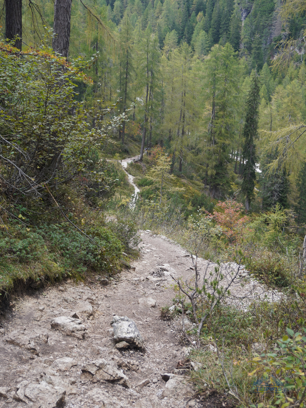
The route to Lake Sorapis starts at the Passo Tre Croci Trailhead. The first short section of the path from the trailhead leads you through a lush green pasture — very “hills-are-alive” sight, which sets an upbeat and cheerful tone to your adventure right away.
The meadow section doesn’t last very long — soon, the wide gravel road ducks into the thick pine forest, shielding you from the sun. Here, the trail starts to cautiously ease you into elevation — while you’re gleefully breathing in the fresh scent of spruce and larch trees, the trail narrows and starts going up.
- By this point, you might get the wrong impression of the path being kind of unchallenging; just enjoy being in the blissful state of naïveté for now!
 |
 |
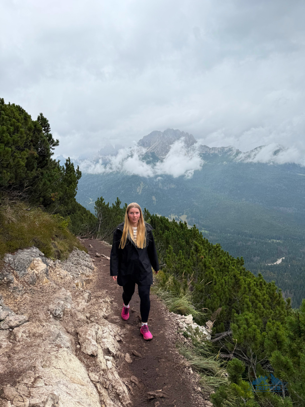
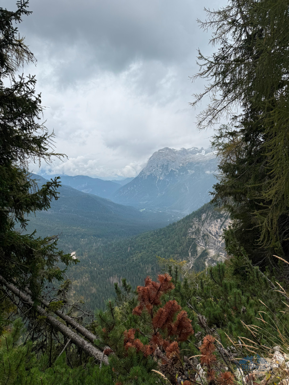
About 30 minutes in, you will start to notice some dramatic mountain peaks emerging through the foliage — get ready, because throughout the hike to Lake Sorapis, you will come upon large open panoramas of Monte Cristallo, Piz Popena, the Cadini di Misurina, and the Tre Cime di Lavaredo. Even if you stay oblivious to what particular mountain range you’re looking at, the maddeningly beautiful sight is bound to blow your socks off!
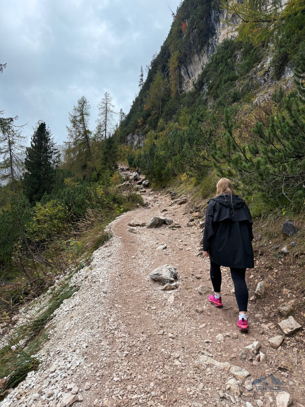
As you start nearing the mountain ledge, the trail starts to throw some unexpected tricks at you. First, a scree field that you will have to very carefully travel over (sometimes using all four points of balance). So hiking boots with great traction and ankle support are a must for the Lake Sorapis trail.
Side note: Also, do not repeat my mistake — since you will need to use your arms a lot, taking a tote bag on the hike might hinder your ability to move with precision. A backpack is the only choice here!
In general, I found the trail to the lake to be pretty demanding. And no, it wasn’t so much because of the kind of terrain you have to walk on, but more so due to inability to lose focus while hiking. Here, you have to be “on” the entire time, without letting your thoughts drift away from trail conditions too much.
 |
 |
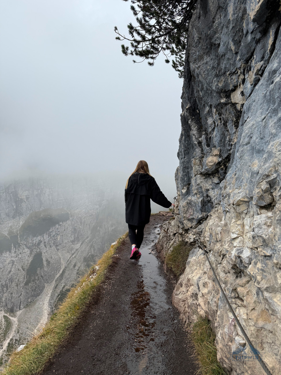
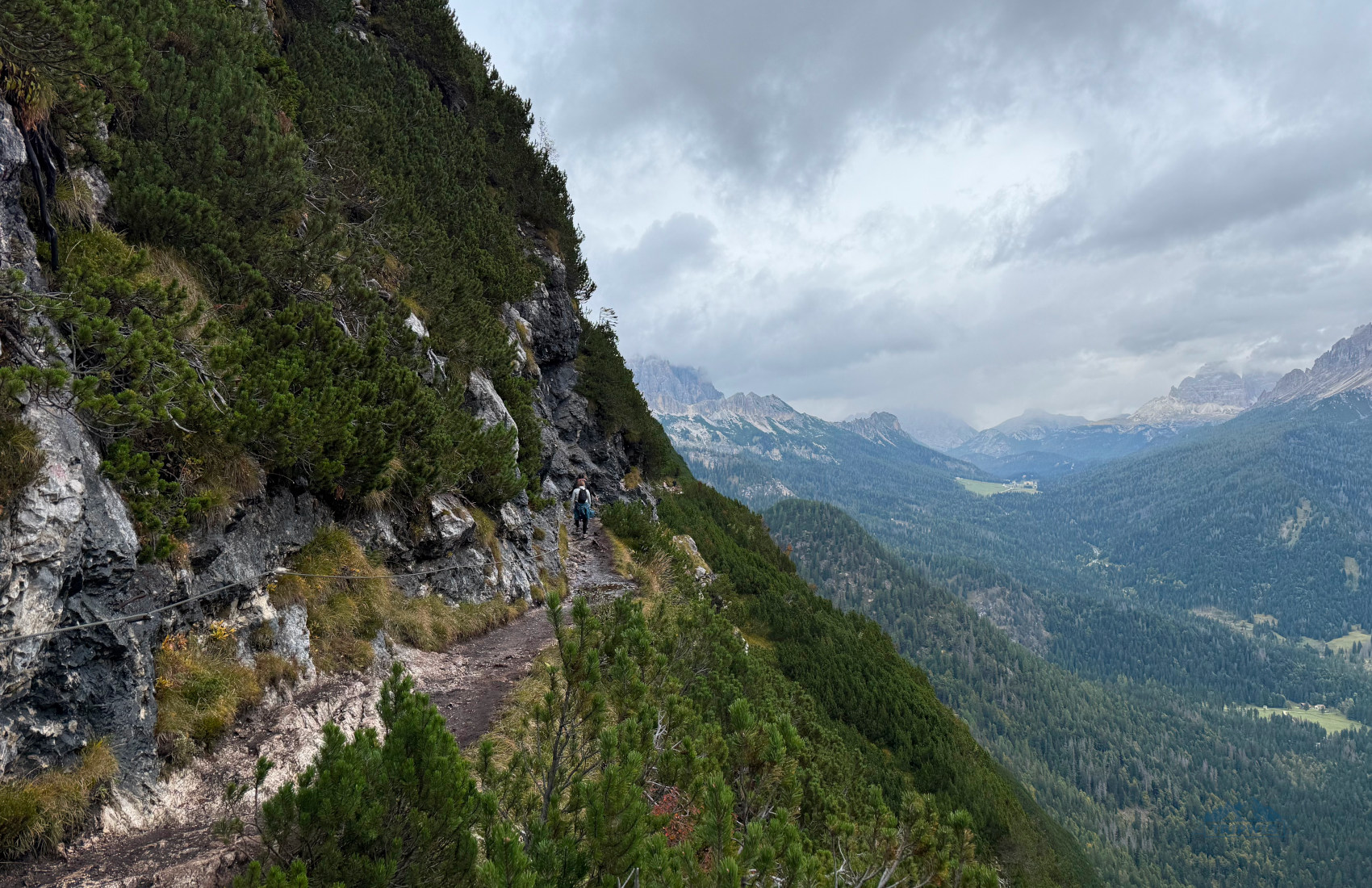
The message becomes even more applicable once the trail starts to contour around the mountain ledge. Imagine a narrow aerial balcony that clings to the side of the mountain, with a steep drop-off into the valley below. Words truly cannot describe a feeling of walking along the abyss on one side and hard rock wall on the other!
Thankfully, some particularly sketchy parts of the trail are supplied with steel cables mounted to the rock wall — you should hold on to them if you lack trust in your sure-footedness. The elevation doesn’t really let down here; expect having to climb on rocks a good amount — the experience made even more difficult by the fact that their surfaces are all polished from too much foot traffic, which turns them slick.
 |
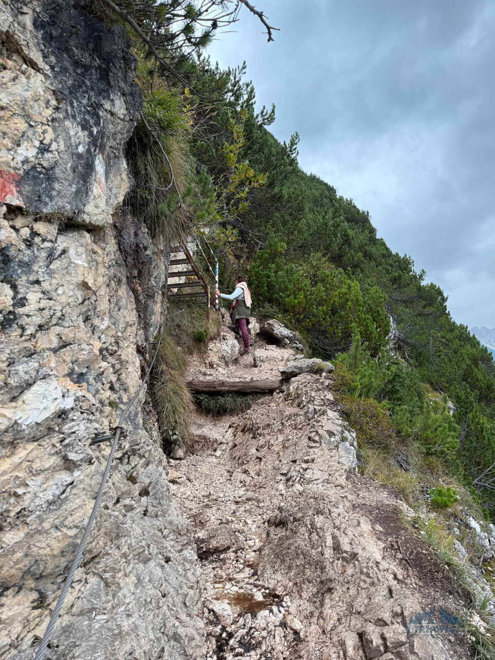 |
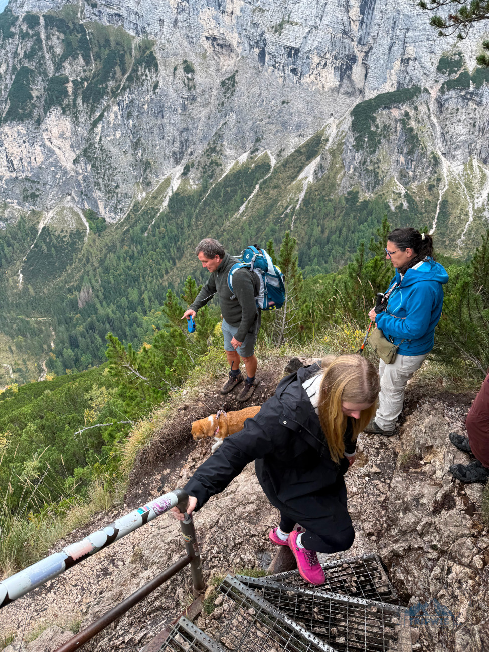
The cables along the route are not the only structures that are put in place to make the hikers’ lives easier — you will also walk on a few wooden footpaths and bridges as well. But the more notable trail features are definitely the metal ladders, which you will encounter after an hour or so (with a little under an hour still to go). The dilapidated state of the steps and railings might’ve spoiled the natural ambiance for us, but the dramatic valley vista that opens up from the staircases definitely brings all eyes on itself. When we stopped to catch a breath here, the experience of looking out onto the valley was almost religious — and pretty scary, might I add!
Soon the narrow rocky trail snakes back under the canopy of the trees. A walk in the forest is the last stretch before you reach an important fork in the road — you can turn left and find yourself at Rifugio Alfonso Vandelli or turn right and reach Lake Sorapis in a matter of minutes.
The mountain hut itself doesn’t offer the view of the lake, as it is set a little away from the main trail. Rifugio Alfonso Vandelli, sitting at 1,926 meters in elevation, is a classic alpine cabin-style establishment that has had quite a few iterations since a rifugio was first built near the lake in 1821. The latest incarnation that you see today was inaugurated in 1966 — so it’s a relatively “modern” site, in all senses of the word. The rifugio only operates during a small high-season window — from June 20 to September 20. And given the fact that it’s the only spot on the trail that offers food and bathroom facilities (plus, overnight stays), I would suggest making full use of the opportunity. They do not accept credit cards, so bring cash if you want to grab a bite here.
We didn’t get to savor local authentic dishes, since our trip fell on the beginning of October. Though the trail and the area surrounding it made me question how in the world does this mountain hut function when the only way to get here is by hiking* (I still don’t have an answer).
*Or by helicopter — here’s a landing pad nearby, but this is more of a last resort for emergencies.
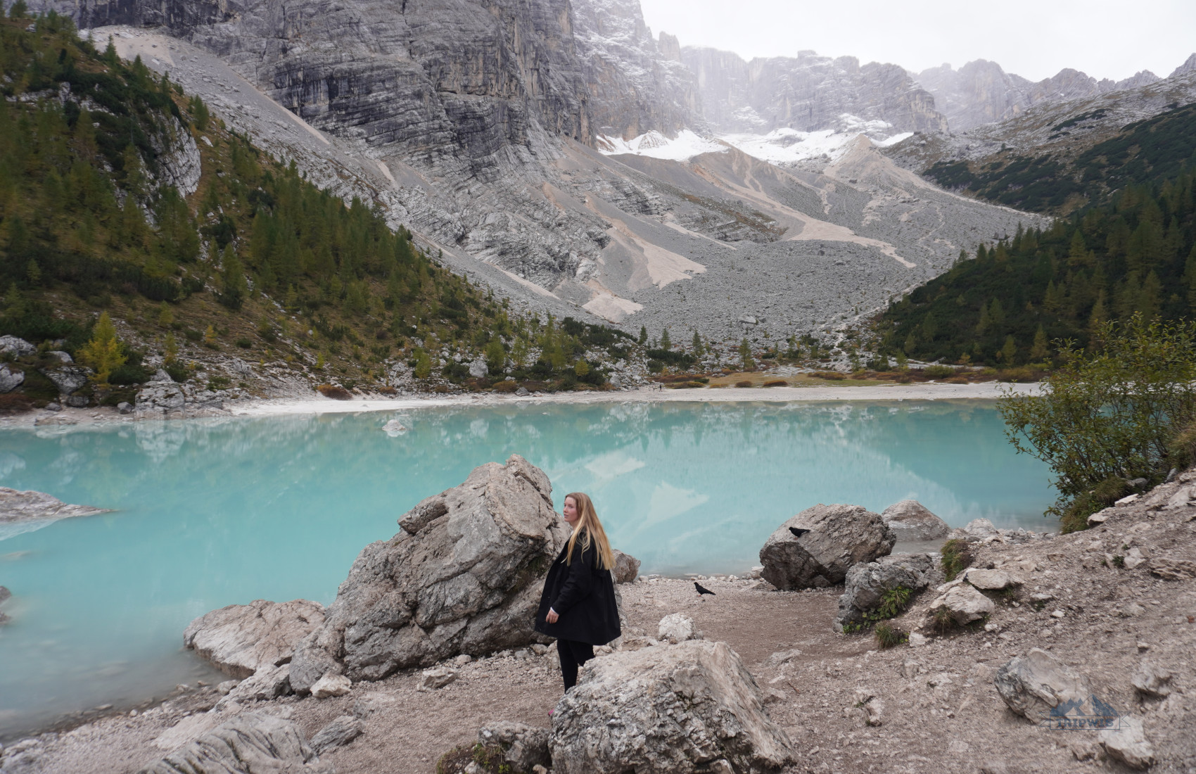
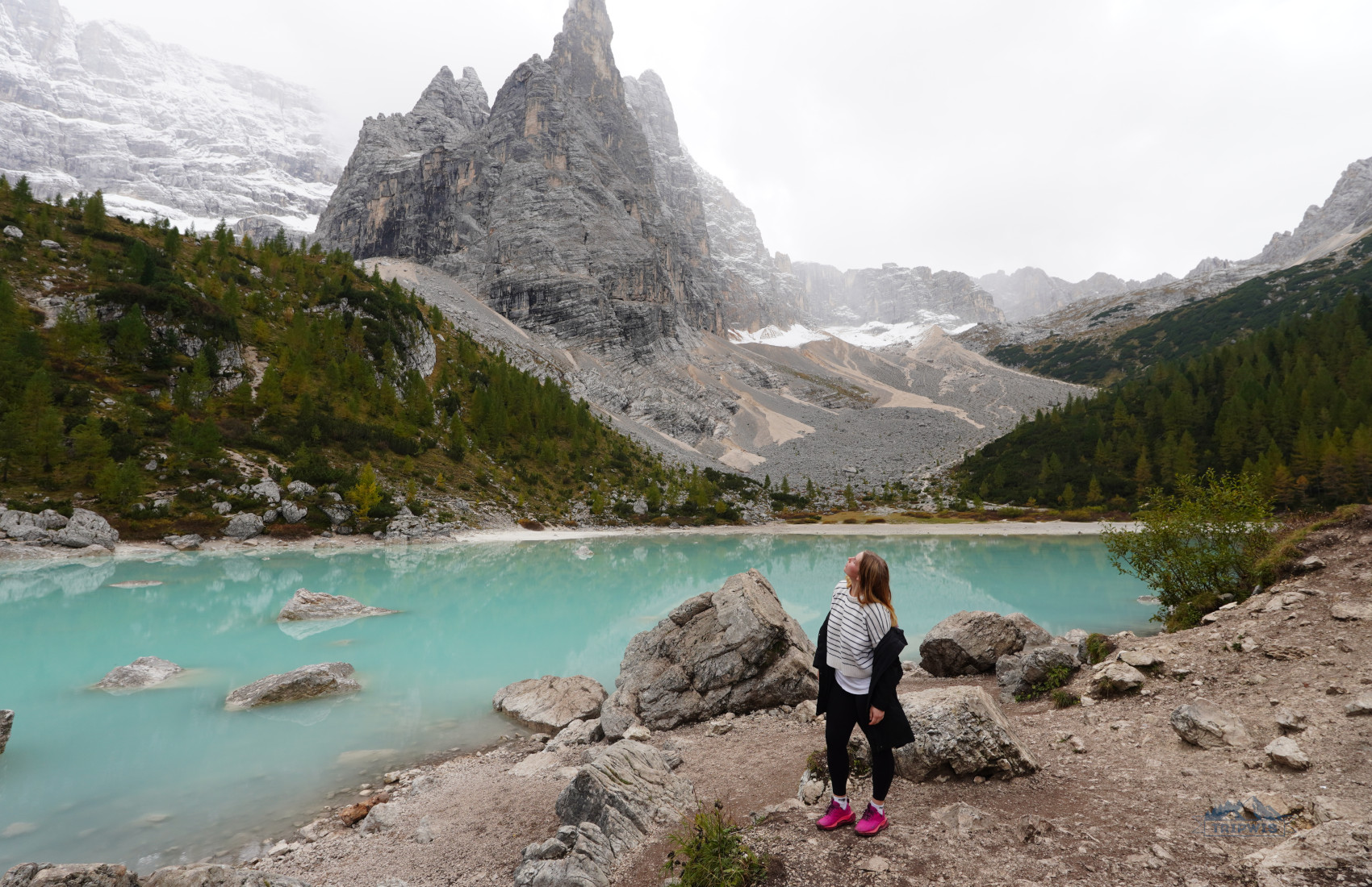
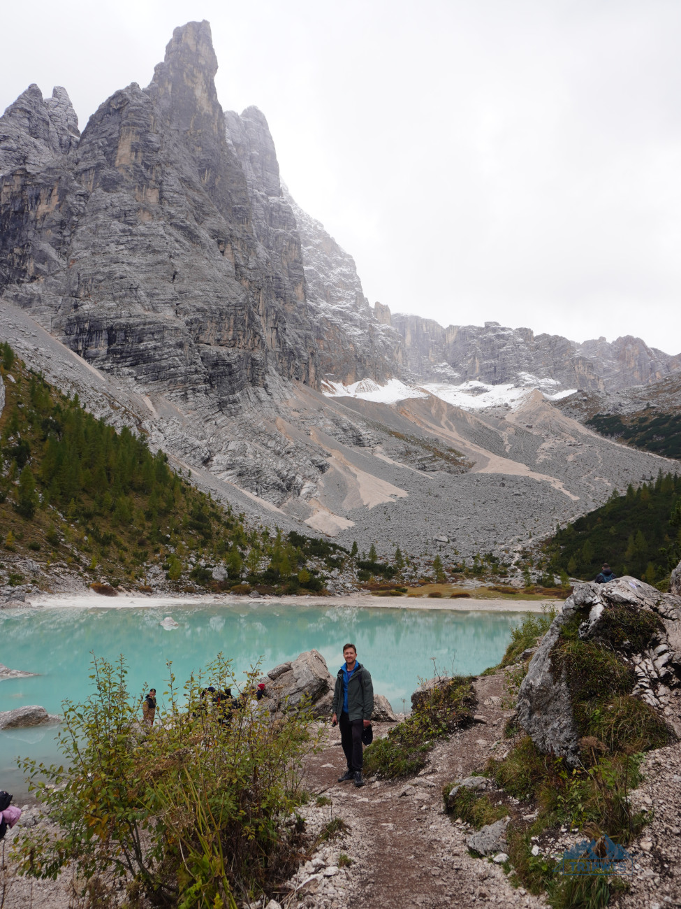
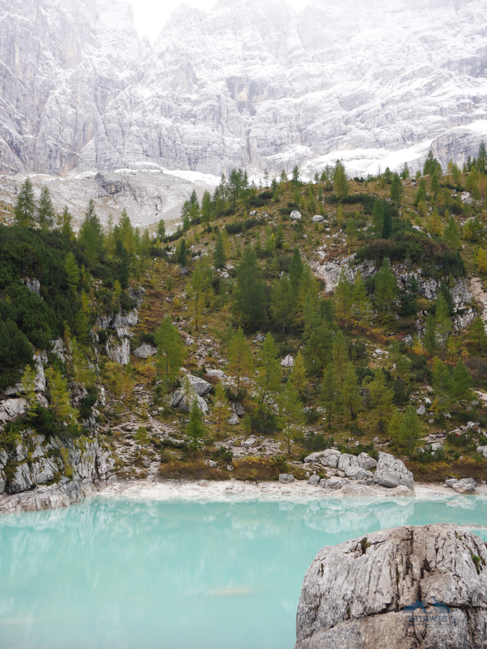
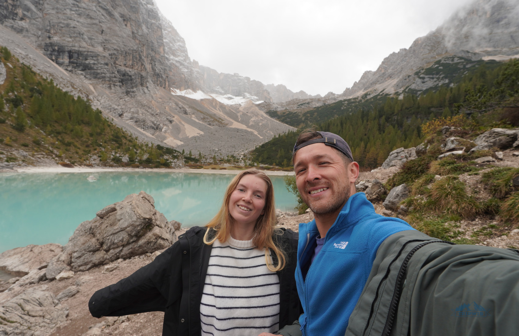
And finally, you come upon the scene you’ve been imagining in your head the entire hike (maybe even contemplating if the pay-off would be worth the effort) — Lake Sorapis is right in front of you. In our concerningly artificial digital age, I definitely thought that the pictures of Lago di Sorapis that I saw online were altered in some way. The truth is, the bright milky blue hue is real — and much more striking when admired with your own eyes!
Why is the water in the lake this color? It is the result of dolomite rock powder being carried from the mountains via Sorapis glacier. The fine dust trickles down into the water as the glacier melts, and then the different lighting scenarios play around with the lake’s tint. The colors range from emerald blue to Gatorade-esque and cerulean — all with a milky-white undertone. The lake is at its fullest in June and July, with gradual decline in water mass in the coming months. Although in early October, I didn’t notice it looking low on water.
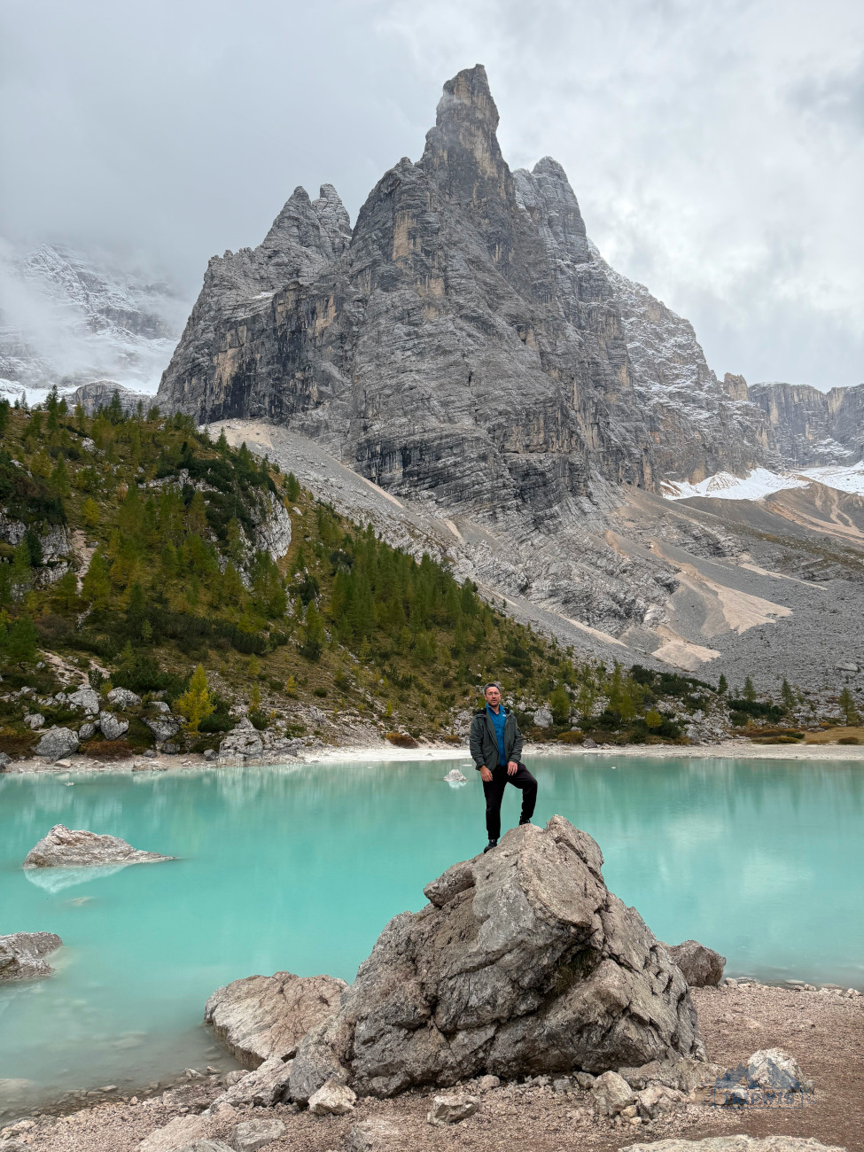
The color of Lake Sorapis is just one of the enchanting attributes of the site — the natural amphitheater of prominent rock walls that surround it is another one, and it’s hard to beat!
- The tallest peak that thrusts upwards into the sky as though a finger is conveniently called Dito di Dio, or Finger of God (2,600 meters). Behind it, Zurion (3,050 meters) and Punta Sorapiss (3,205 meters) create an impenetrable wall, though hiding a Narnia-like world behind them.
The chances of crowds near the lake and on the trail differ depending on the season, but if you find yourself at the shoreline together with a few dozen of other travelers, you should consider getting away from all the action and doing an additional loop around the lake. Just choose either direction and set off on a 45-minute adventure — that way, you’ll escape crowds and also find new unique angles to admire the lake from.
Side note: Be careful not to enter the water — swimming in Lake Sorapis is prohibited due to it being a very fragile ecosystem that cannot take in this much human traffic without negative consequences. The shores easily erode too.
 |
 |
Once you’ve taken the highly coveted picture on a large boulder in front of the lake and all the mountain drama, it’s time to head back.
It took us 2 hours to get to Lake Sorapis from the trailhead, and just under 2 hours to retrace our steps back to the car. Before that, we were doing loop hikes in the Dolomites, so we thought that taking the same trail back would be easier — however, since we knew what to expect, we were not very excited about the route. Still, we trudged onward, the setting sun coloring the valley in shades of yellow, orange, and red.
As we started nearing the car, the thought of grabbing a bite at Baita Son Zuogo (which translates to “At the top of the Pass”) crossed our minds. Located mere 400 meters from the trailhead, most travelers stop here after completing the hike, highly praising the menu and a large outdoor terrace with great views.
 |
 |
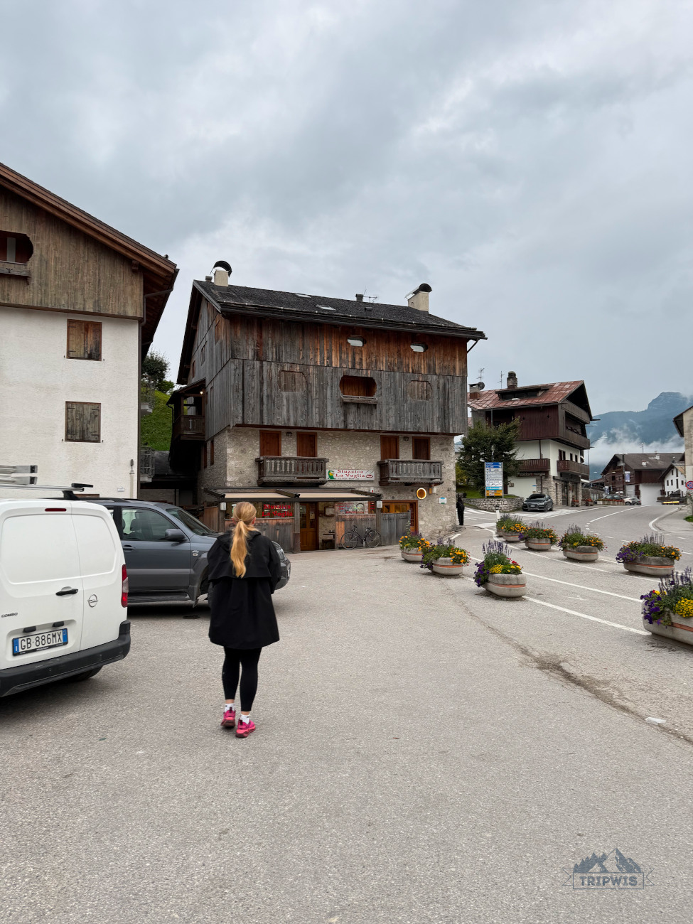
Personally, we held off on the food reward until we reached the village of San Vito di Cadore, where our hotel — 3* Best Western Hotel Nevada — is located. And I’m so glad we did. The Stuzzica La Voglia pizzeria was just what the doctor ordered. Here, even a simple Margherita (€7.5) or Prosciutto (€8) pizza feels particularly scrumptious — a luxury that comes with using fresh local ingredients. Of course, if you’re bone-tired, even an order of a Nutella pizza (€13) sounds like a great choice — and who are we to judge?
The optional loop hike via Forcella Marcuoira
 |
 |
I understand that not everybody likes the idea of retracing your steps via the same trail you came to Lake Sorapis on — where’s the fun in that? This is why I decided to mention an alternate Lake Sorapis trail option — the loop trail that takes you back to Passo Tre Croci via Forcella Marcuoira. But just to give you a heads up — this path is even more challenging than the one I’ve covered above.
- Distance — 14 kilometers (8.7 miles); 6.8 km from the lake back to the trailhead
- Total ascent and descent — 900 meters (2,929 feet)
- Hike time — over 5 hours (of which 3 hours is just the way back)
- Hike difficulty — difficult
This loop trail is best undertaken by experienced hikers only, as there are a lot of tough sections where some technical knowledge would come in handy.
After you reach a fork in the road on your way back from Lake Sorapis, continue left on the trail 216 (marked as the one to Cladin del Loudo). This new path will show you its true colors right away — it’s an uphill walk from the very beginning. There are some cable-secured passages here as well, but they do not feel as nerve-racking as the ones on the trail 215 to Lake Sorapis.
This section is followed by a sketchy descent into the grassy basin of Ciadin del Loudo, followed by yet another climb to Forcella Marcuoira. The saddle is a great place for a break.
A short breather is definitely necessary for what’s to come — the other side of the saddle is a steep drop-off into a pass which you will have to navigate. This section requires some heavy hands-on scrambling; but once it’s over, you know the end of the hike is near. As you hit another intersection, make a sharp right turn onto the trail 213, which will take you back to the trailhead via a very gentle descending slope that goes through the forest.
And there you have it! Not to sound like a broken record, but the loop hike via Forcella Marcuoira is best fit for experienced hikers, with sufficient knowledge of this particular Dolomites terrain.
Best time to hike to Lake Sorapis + other tips
When is the best time to visit Lake Sorapis?
Lake Sorapis is not a year-round destination — the window for hiking the trail is from mid-June to early October. In my opinion, there are three distinct “seasons” to consider planning your adventure for:
- Mid-June to early July — this is when the trail is finally back in operation after winter season (though some years, snow might still linger in a few sections). Sorapis Lake is at its fullest during this time span, and though the crowds are already here, the situation is not as bad as in the following period.
- July to mid-September — peak season for hiking Lake Sorapis. The lake is bright turquoise and still full. The weather conditions are most favorable for the trek. One major downside of this period are the crowds — the trail turns into a highway for hikers, with long lines for the cable-lined passages and other narrow parts. The lakeshore is also super packed this time of year, so a loop trail around Sorapis is a necessary step to enjoy the scenery in a relative solitude.
- Late September to early October — our personal pick for the best time to hike to Lake Sorapis. The cooler temperatures provide better environment for strenuous hiking as an activity; however, first frost might render the path even harder to walk on. Shorter days during this period should encourage better planning and time management, though setting on the hike after 3 p.m. is a bad idea even during peak summer season. We particularly liked hiking to Lake Sorapis during early October because there were not a lot of other people on the trail (we saw lots of videos online of how bad the congestion on the hike could get). The lake’s water levels are said to be low during this time, but I felt that the magic was still there. However, come mid-October, the water drops significantly, and then the lake starts freezing over closer to the end of the month.
What is the best time of day for hiking to Lake Sorapis?
Early morning is the best time to start your hike to Lake Sorapis. However, there’s a caveat — do not begin your journey in the dark, since the trail is hard enough to traverse on even in broad daylight.
If you’re doing an entire string of hikes in the Dolomites (our itinerary was booked to the brim most days as well), then the idea of early morning wake up call might seem impossible. Thankfully, an afternoon hike to Lake Sorapis is just as enjoyable. Our starting time was 1:30 p.m. and we finished the hike just around 6 p.m. — there was already some turnover at the parking lot so we found a spot relatively quickly, there weren’t a lot of people going in the same direction as we were, and by the time we reached the lake, most crowds have already cleared the shore. That’s what we call a win-win-win situation! One thing to keep in mind when starting your journey to Lake Sorapis later in the day is the time the sun sets — you don’t want to be scrambling back to the trailhead in the dark.
Is the hike to Lake Sorapis difficult?
Though the Lake Sorapis hike difficulty is widely disputed, I think we can all agree that it is hard — at least for inexperienced hikers. If you’re the Reinhold Messner or the Alex Honnold type, then it will feel like a walk in the park. Objectively, however, the elevation gain combined with slick rocks and narrow ledges make the hike feel at the very least moderate, with each consecutive circumstance (bad weather, wrong gear) leaning the overall rating towards “hard”.
Even though we’re not seasoned mountaineers ourselves, we clearly underestimated the hike to Lake Sorapis — our entire bodies were sore the next day.
What to wear to hike Lake Sorapis?
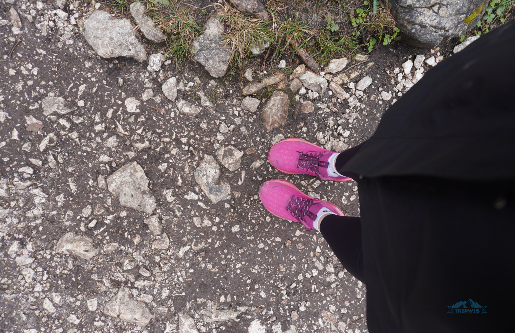
The most important part of your outfit for Lake Sorapis are the proper hiking shoes — you will need good traction and ankle support. The light-colored shoes are bound to be dirty beyond belief by the time the hike is finished — Lake Sorapis trail is no paved road!
Layers are also crucial for the hike, since even in peak summer, mountain climate may throw unexpected cold bouts of wind or even rain showers at you. So, a waterproof layer is a must. Plus, pack a dry base layer for when you pause at the lake — the sweat from the arduous hike will make you cold the second you stop.
A sun hat, sunglasses, and SPF to reapply are needed in summer months — apart from the first and last shaded sections in the forest, you will be constantly exposed when trekking to Lake Sorapis.
What to pack for the Lake Sorapis hike?
It’s a long hike, so pack enough water and food to last you for 5 hours. The only place to eat and drink is set right by the lake, and even so, the rifugio might not be open during the time of your trek. Besides that, an offline map is a must — though the trails are clearly marked here, you can never be too prepared. Trekking poles are a good idea if you feel like you need better aides for balance on the tricky terrain.
Are there facilities on the trail?
The only facilities (restroom, water refill, restaurant, lounge area) on the trail are all offered by Rifugio Alfonso Vandelli — it usually operates from June 20 to September 20.
Can you bring your dog on the trail to Lake Sorapis?
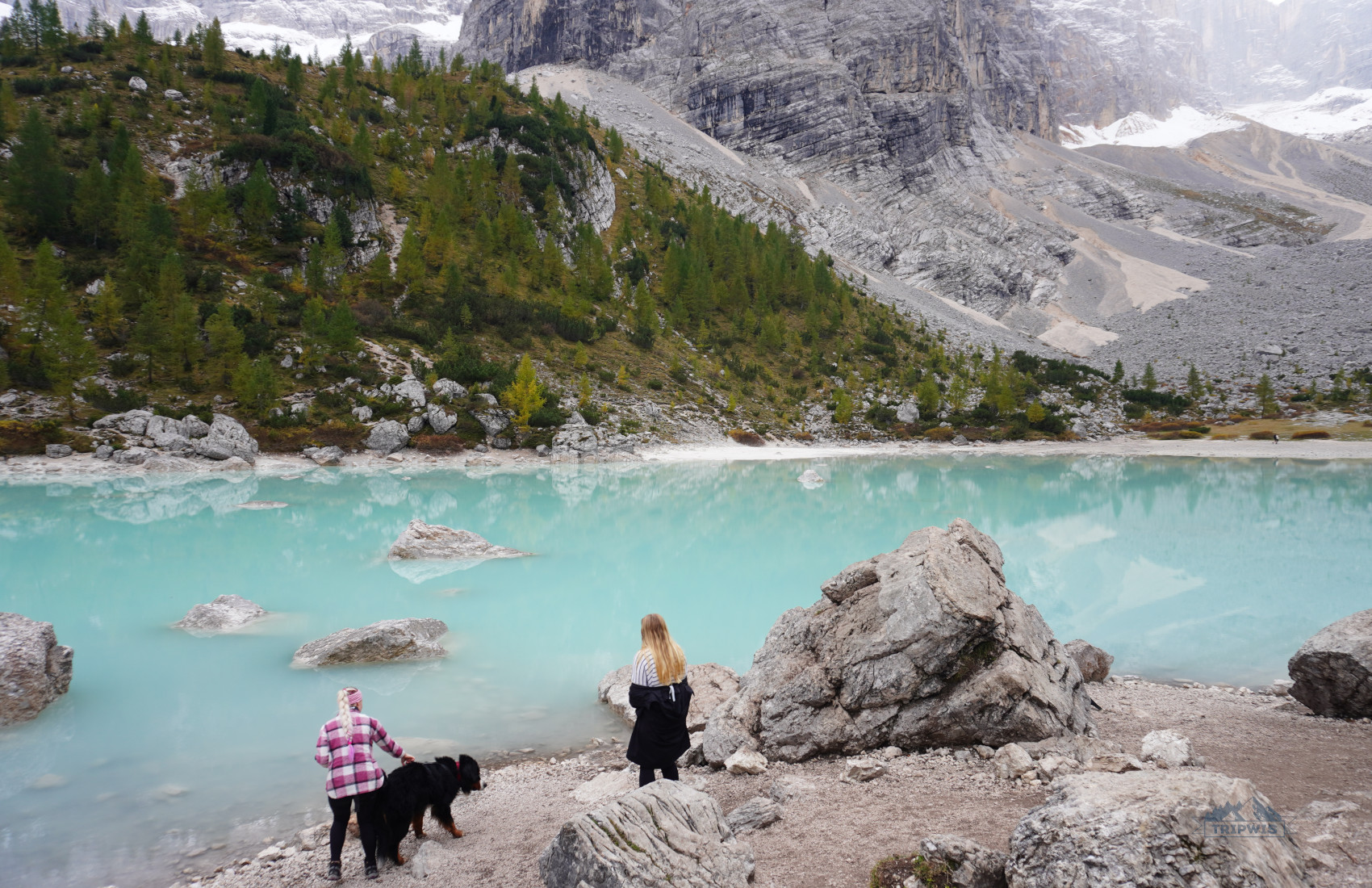
The trail is marked as dog-friendly, and we did see plenty of pups while en route to Lake Sorapis (and by the lakeshore). The dogs should be leashed at all times. However, I would discourage bringing your furry companion if it’s not a generally active dog — the hike is long and hard, and it might be too difficult for an average canine.
Is the hike to Lake Sorapis worth it?
This question I can answer without a hint of doubt — the hike to Lake Sorapis is one of the most memorable experiences I’ve had in the Dolomites, and that makes it worth every second of struggle and grit. Sure, the trail is difficult, but it makes you feel like you’ve earned the jaw-dropping panoramas — there were no cheat codes like a cable car or a mountain bike ride to get you here.
Additional tips about the Dolomites
Now that you’re caught up on the essential info for hiking Lake Sorapis, let’s zoom out a little and give you a short overview on the experience of exploring the Dolomites in general.
Car rental in the Dolomites
If you, like us, want to visit quite a few gorgeous natural sites in the area, then renting a car in the Dolomites should be the first item on your travel to-do list. Though public transport here is pretty reliable, it still adds unnecessary setbacks to the experience that could otherwise be pretty seamless with a rental car.
- Personally, we used the service of DiscoverCars to rent a car in Milan upon landing there (we flew here from Barcelona for €20 per person).
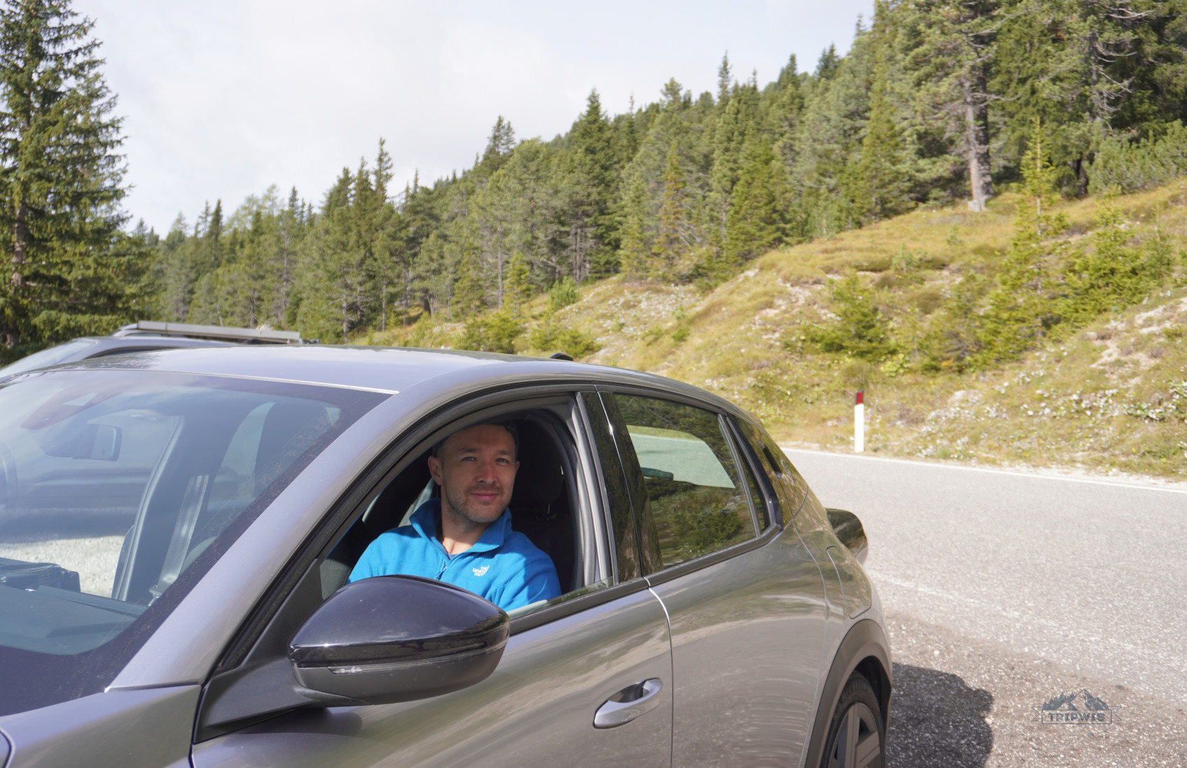
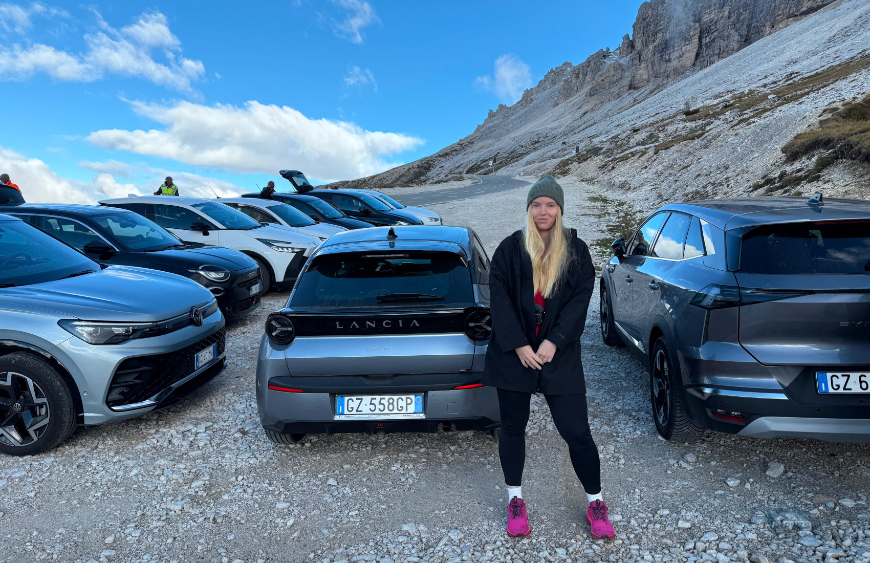
After splurging €19 on toll roads from Milan to South Tyrol, we found ourselves surrounded by dramatic peaks and buttercup meadows. Since we were getting to know the Dolomites in the off-season, the price for our rental was a complete steal — we paid €80 for six days (!) for our new Lancia Ypsilon.
Where to stay in the Dolomites?
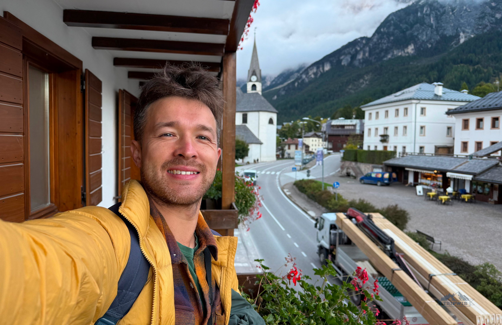
As I’ve already mentioned above, I believed that basing ourselves in San Vito di Cadore would be an ideal scenario for being close enough to easily access both Lake Sorapis and Tre Cime di Lavaredo trailheads. I was 100% right, as our stay in the cleanly furnished 3* Best Western Hotel Nevada was restorative to the highest degree.
Our other hotel picks in the Dolomites were:
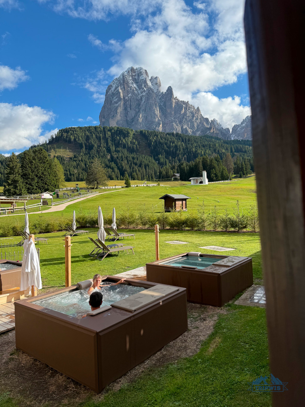
🔹Hotel Everest (Trento) — we stayed here overnight after the long drive from Milan
🔹Monte Pana Dolomites (Santa Christina) — our base for exploring the Val di Funes region (Alpe di Siusi and Seceda)
🔹Gasthaus Zum Weissen Kreuz (Lazfons) —a guesthouse for one night after the Tre Cime hike and before the Adolf Munkel hike
 |
 |
Back to Sorapis, Cortina d’Ampezzo also has some hoteldom heavy lifters to choose from, both from budget (a relative characteristic in the Dolomites) and premium segments:
- 2* Hotel Montana (from €210 a night) — a charming Alpine-style hotel with a knockout location: It is set near Cortina’s most popular pedestrian street. Though a view of the Byzantine tower made entirely out of dolomite stone is an impressive panorama, the bell ringing might be a nuisance you will have to deal with during your stay. The postcard-worthy wooden facade of Hotel Montana, adorned with flower beds in warmer months, runs a cohesive theme with the rooms’ overall design — despite the small size, the suites lend a feeling of spaciousness with all the neutral tones and wood accents.
- 2* Hotel Oasi (from €220 per night) — moving away from Cortina’s quaint and fairytale-esque city center, Hotel Oasi is set right beside the road that will take you to Lake Sorapis trailhead. This unassuming family-run hotel bears all the necessary characteristics for a delightful stay in the Dolomites: A beautiful balcony-clad exterior, a lush garden on the premises, amazing views of snow-dusted mountains, free on-site parking, and a buffet breakfast spread rich with local fare. If all of this doesn’t make you run and book a room at this mountain manor, I don’t know what will!
- 3* Hotel Serena Cortina (from €260 a night) — set in the historical building, this hotel has been an important presence in the town since the year of its establishment — 1906. The rooms are divided into Superior (the refurbished ones, with oak and stone accents and an impressive degree of automation; they are said to mirror the qualities necessary for a 4-star rating) and Classic ones (the older suites which are still fine, spick-and-span rooms that have that old world charm intact). The head-spinning mountain views and the well-loved à la carte restaurant are the specialties synonymous with a great sojourn in the Dolomites.
What is the most beautiful hike in the Dolomites?
 |
 |
I hope that my guide to hiking Lake Sorapis in 2026 has helped you create a plan that best fits your needs/wants/abilities (remember to not underestimate the trail!). And though I feel that Lake Sorapis is arguably the most beautiful destination in the region, our latest trip (that also included other four of the most popular hikes in the Dolomites) proved that the mountains’ varied settings and different hiking scenarios always create a wonderful sight:
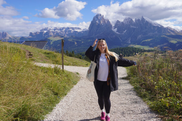
- Alpe di Siusi — an easy 4.5 km Panorama Loop Trail that gives you a peek into the traditional yodel-country postcard of rifugios, cows grazing on the flower-carpeted meadows, and towering mountain edges, all situated on the largest alpine plateau.
- Seceda — the ridgeline’s needle-like peaks that thrust their ends towards the sky are the reason we set off on the 10 km loop journey from Col Raiser cable car (a better and cheaper version of the aerial lift towards Seceda).
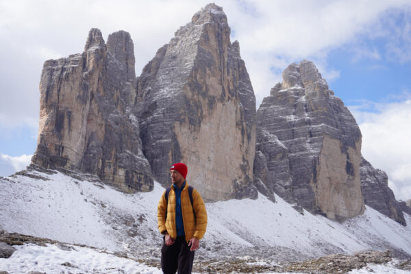
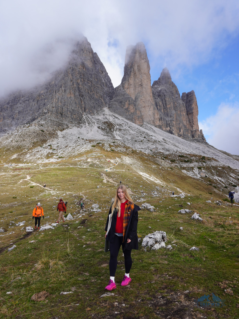
- Tre Cime di Lavaredo — an easy-to-moderate 10 km loop trail that we personally coined as the most overhyped of the bunch (the parking situation alone almost rendered the hike not worth it). Still, the heart-stopping panoramas of the Three Peaks of Lavaredo — behemoth grey spires that are piercing the clouds — are deemed worth the troubles.
- Adolf Munkel — a moderately easy 10 km loop trail that lets you enjoy the views of the Dolomites’ darling Odle Group from an entirely new angle; all the while you’re traversing over meadows and ducking into the lush coniferous forest stretches.