It was our fifth day in the Dolomites, and the gradually accumulated fatigue made me pick an adventure that was a little easier on our bodies, while still being stunning in that unmistakable Dolomites way.
Hiking Adolf Munkel trail was a no-brainer decision – the path doesn’t require too much physical exertion, the length is reasonable, the scenery is pleasing to the eye, and the value for money seems to be fair.
Since Adolf Munkel is lesser known than some other “big players” in the area (Alpe di Siusi, Seceda, etc.), it doesn’t get the same amount of coverage online. I set off to change that, creating this guide to hiking Adolf Munkel trail in 2026: Here, I will give you a step-by-step breakdown of the route, some practical tips, and drop valuable information on facilities and services that you need to have at your fingertips in the Dolomites.
Article contents
- How to get to Adolf Munkel trail?
- Key details about this hike
- Adolf Munkel trail overview
- When to hike and other FAQs
- Car rental in the Dolomites
- Where to stay in the Dolomites?
- What is the most beautiful hike in the Dolomites that we did?
How to get to Adolf Munkel trail?
After spending a small fortune on a cable car ride to Alpe di Siusi and a parking lot reservation for Tre Cime di Lavaredo, the process of getting to Adolf Munkel trail starting point seemed to be the most budget-friendly scenario we could hope for in the Dolomites.
But before, let’s address the issue of double – sometimes triple – names of locations in South Tyrol. Because of its difficult history (the region once belonged to Austria, before becoming a part of Italy after WWI), both Italian and German names are used interchangeably to refer to the same thing. Sometimes a Ladin name may be thrown for good measure as well; it is an ancient language spoken by a handful of Dolomiti residents.
To avoid confusion when planning your outing, you can refer back to this list of places you need to know:
- Adolf Munkel trail (Via delle Odle in Italian and Adolf Munkel Weg in German) – the very path that you will be traversing on.
- Val di Funes (Villnöß / Villnößtal in German) – an alpine valley in South Tyrol, home to the Adolf Munkel trail.
- Puez-Geisler Nature Park (Parco Naturale Puez Odle) – a nature reserve; about half of the trail lies within its limits (Seceda is also a part of this park).
- Odle / Geisler mountain group (Geislerspitzen / Gruppo delle Odle) – the star of the Adolf Munkel trail; it’s the most prominent mountain range in the park.
- St. Magdalena (Santa Maddalena) – one of the most charming settlements in the valley.
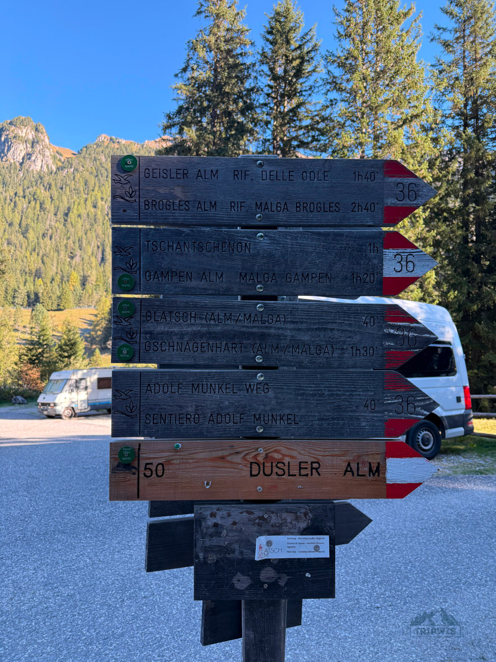
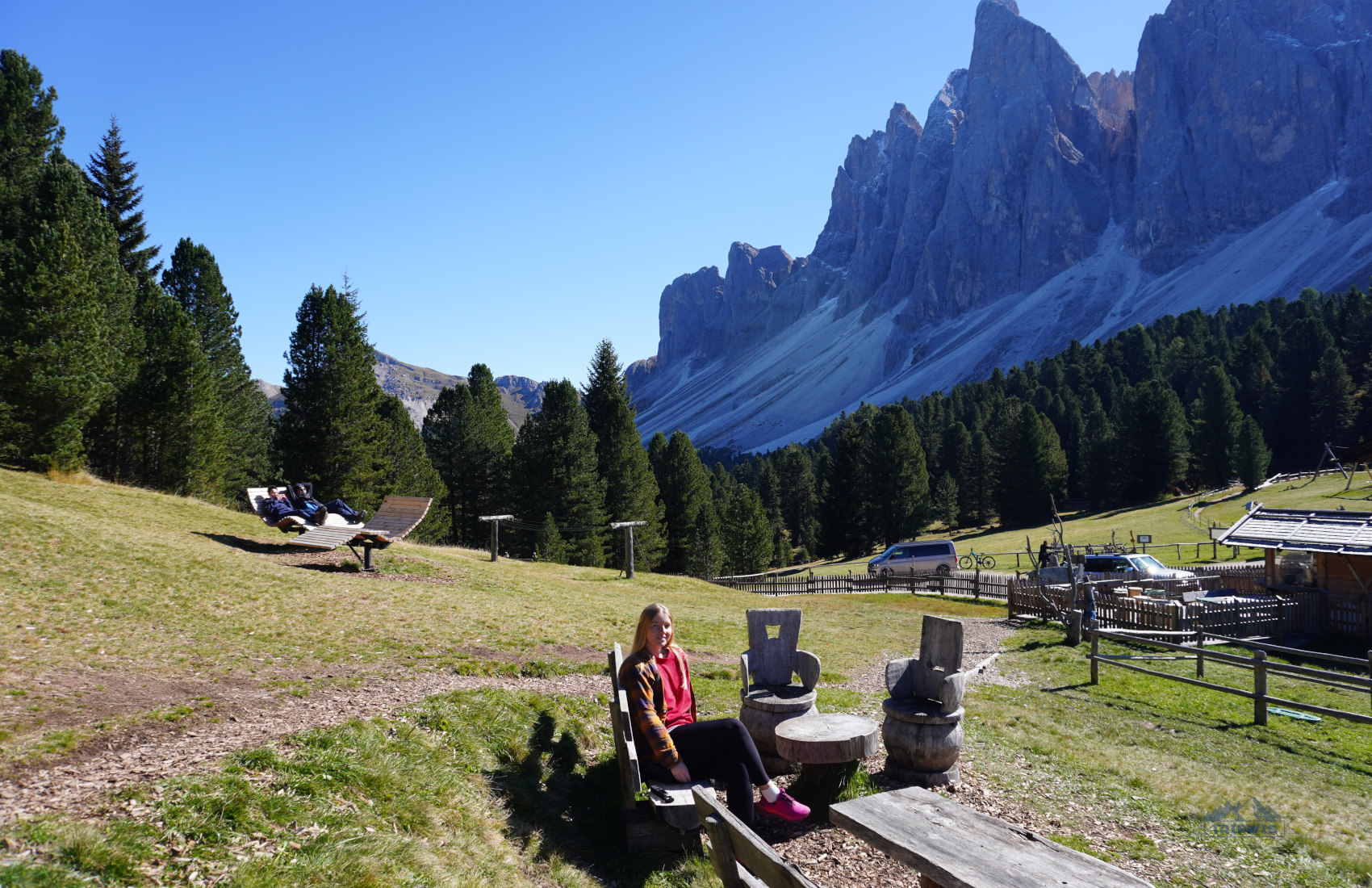
- Zannes / Zans parking lot (Parcheggio Zannes / Parkplatz Zanser Alm) – the starting point of the Adolf Munkel loop trail, set right by rifugio Zanser Alm.
Realistically, there are two main ways to get to the trailhead – by car and by bus. However, the more intrepid adventurers would be pleased to know of an elusive third option, which includes a cable car ride and quite a bit of hiking.
By car
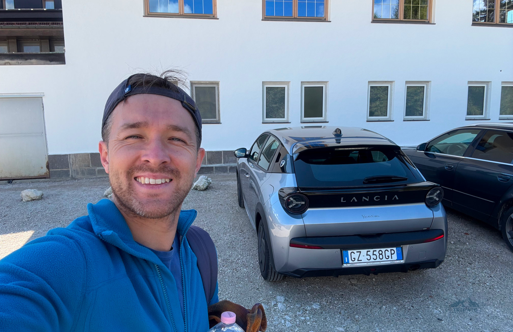
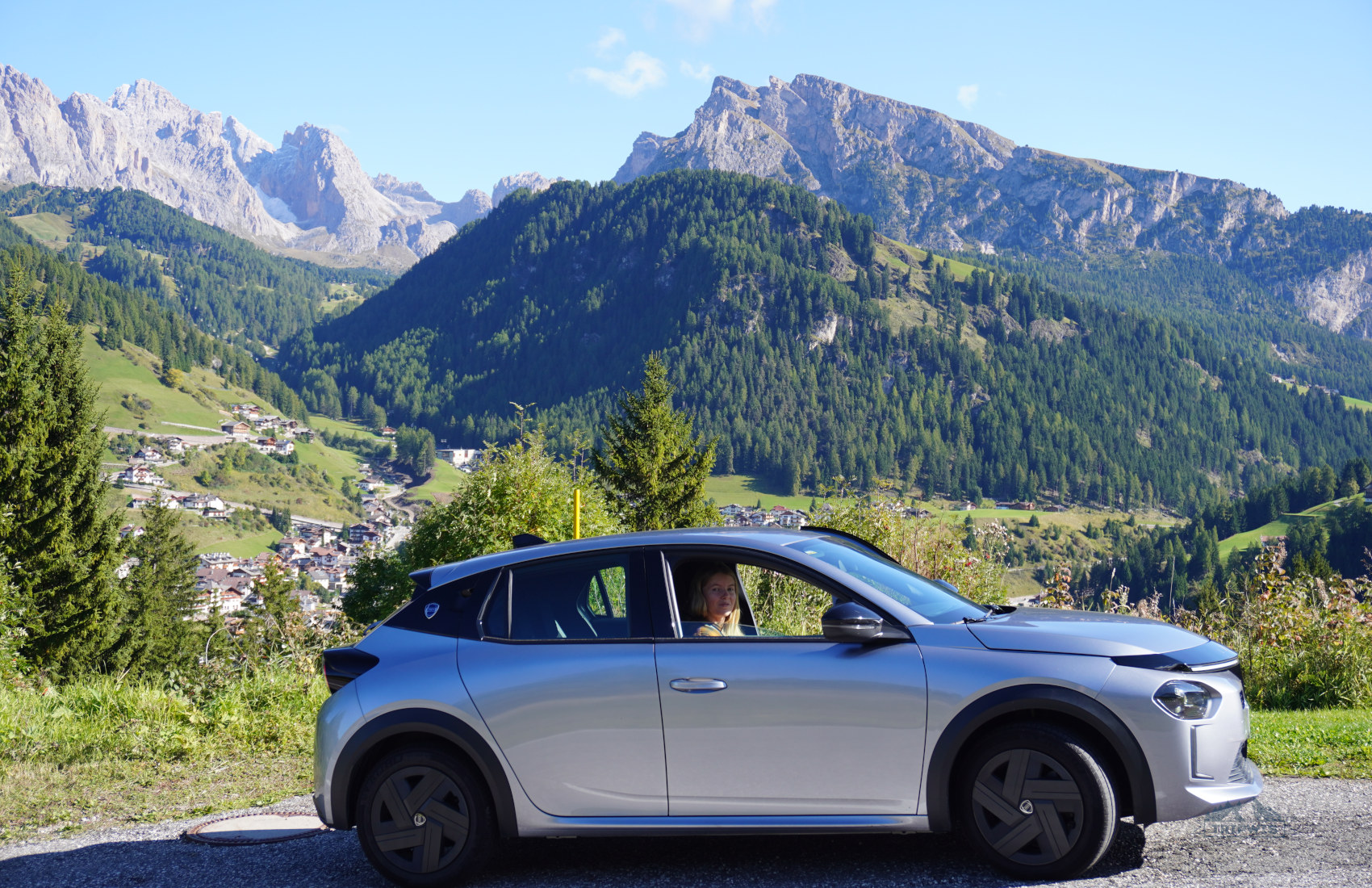
This time in Italy, we rented a new Lancia through Discovercars
The valley of Val di Funes where you will be traveling to for the hike is a pretty well-connected region in the Dolomites. The starting point for the Adolf Munkel Trail is set about:
✔️ 45 minutes away from Brixen,
✔️ 1 hour away from Bolzano,
✔️ 1 hour from Ortisei,
✔️ and 2 hours 25 minutes away from Cortina d’Ampezzo.
No matter what direction you’re coming from, just put the name of the closest rifugio to the trailhead – Zanser Alm – into your GPS and you will be golden.
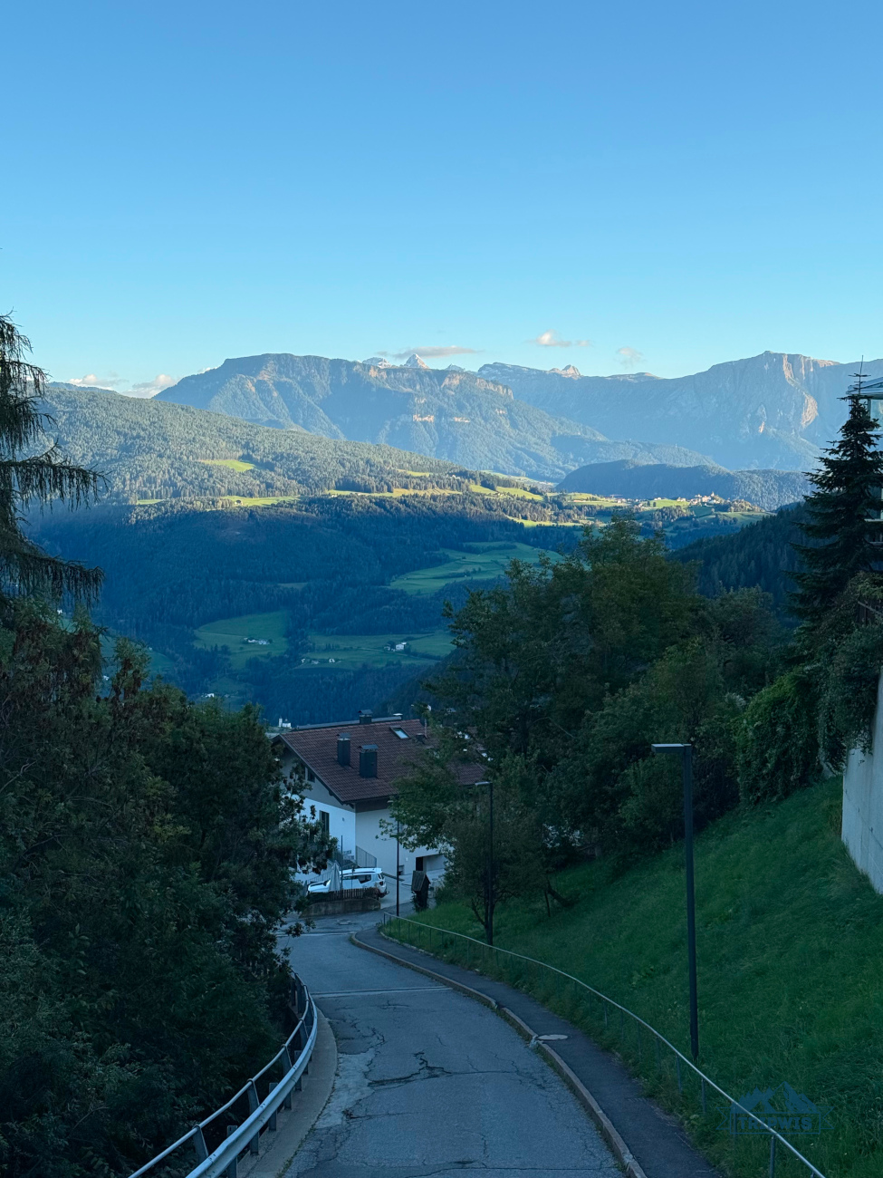
❗️The only thing to keep in mind is the last 4 km to the parking area, which run along Via Zanser road. Be mindful here: It looks like it’s a one-way road because it’s so narrow, but it actually has two-way traffic.
What makes getting to Adolf Munkel unique is the deliberate driving to its trailhead. You cannot simply stumble upon it on the way to some other location in the Dolomites, unlike the starting point for the hike to Lake Sorapis.
Adolf Munkel trail parking
As far as I remember, this is the most spacious trailhead parking lot anywhere in the Dolomites
Speaking of parking, I cannot dive into the details of hiking Adolf Munkel without shining the light on the parcheggio situation here first.
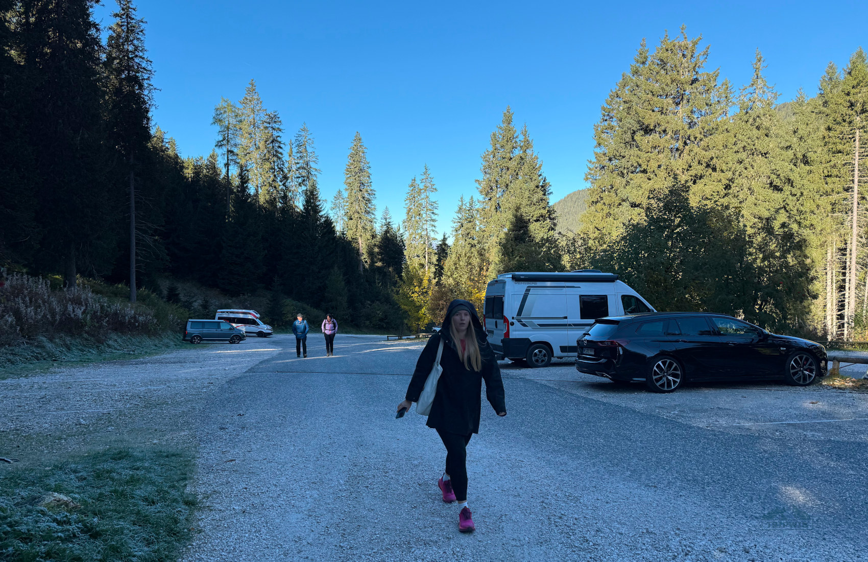
Though I saw a mention of four separate areas to park near the starting point online, realistically, there are two: Parcheggio Malga Zannes (Parkplatz Zanser Alm) 1 and 2. The first one is the larger parking area, the one where we parked at – it’s got about five parking rows, with plenty of spaces. The second parking area is a little way away, making it a less desirable option.
❗️As you drive past St. Magdalena, you will see an electronic tableau at the beginning of a road to Zanser Alm. If the signboard is green, then there are still free spots at the lot. If it’s red, that means the parking’s full. However, in the latter case, the road still remains open; you will just have to wait by the entrance gate for somebody to leave (in a one-in/one-out fashion). Alternatively, you can leave your car at one of the St. Magdalena car parks (€15 a day), and either take the bus 330 or hike to Zanser Alm.
There is a staffed booth by the parking lot entrance; the attendants will tell you where to park. This is also where you pay for parking near Adolf Munkel (bring coins and cash).
The rates, when compared to, say, Tre Cime di Lavaredo, are pretty reasonable:
- €10 per car
- €16 for a campervan
- €4 for a motorbike
There’s a nighttime rate of €40 from 9 p.m. to 7 a.m., since it’s a car park that works 24/7.
Parking lot for Adolf Munkel trail fills up very fast in high season, so try and arrive early in the morning.
Our experience: At the beginning of October, we started our 40-minute way to the hike from Latzfons (stayed there at Gasthaus zum Weissen Kreuz). We came shortly after 8 a.m. and managed to find a spot quickly, but after 1 p.m., the entire lot was chock-full of cars. If you’re not really an early bird, plan an afternoon hike – after 3 p.m. when all the morning hikers begin to leave.
Is there an Adolf Munkel trail parking reservation? I found a website for it here, but I do not think that it’s necessary. Again, it’s not a requirement like at Tre Cime di Lavaredo; just come early enough to snag a spot on-site and you’ll be fine. Either way, there are always workarounds.
By bus
If you make it a point to use more eco-friendly means of transportation, then there is a public transport option to get you to Zanser Alm.
The only bus that gets as far as the bus stop near rifugio is bus #330. It departs from Brixen, with multiple stops along the way, and runs roughly every hour in high season. The first bus leaves Brixen at around 7:30 a.m. and the last bus departs from Zanser Alm at around 6:30 p.m. The ticket costs €8,5 one way from Brixen and €4 from Santa Maddalena.
On foot
How to get to Zanser Alm on foot? Set off on a trail from Ranui to the Adolf Munkel trailhead. It will take you under 1.5 hours, and the hike is quite easy, since it is mostly covered (you are walking through the forest essentially).
Sometimes, when the parking lot at Zanser Alm is full, it will be a sound option to get to Adolf Munkel trailhead (if you don’t want to take the bus).
Adolf Munkel trail key points
 |
 |
One unexpected discovery on this hike was that you can actually see the valley you’re standing in from Seceda!
Let’s get one thing out of the way: Just because Adolf Munkel is not as widely known as other hikes in the region, it doesn’t mean that it’s some long-forgotten and isolated gem in the Dolomites. On the contrary, I’ve seen countless pictures and videos of the trail’s prime view – the dramatic Odle Group peaks thrusting their outstretched hands high into the sky.
- The trail was created a long time ago – in 1905 – and named after a German mountaineer Adolf Munkel.
Officially, the Adolf Munkel trail is a 9 km path that stretches between rifugios (mountain huts that offer dining, leisure, and sometimes even overnight facilities). However, these cannot be accessed by car, so a loop trail from the parking lot is the solution most travelers choose to stick to. The path from the lot merges with the main trail, creating the route that is widely referred to as the Adolf Munkel trail loop.
Adolf Munkel loop hike stats:
- Distance – 9.5 kilometers (5.9 miles)
- Total ascent and descent – 464 meters (1,522 feet)
- Hike time – 3–3.5 hours (includes a lengthy rifugio stop)
- Hike difficulty – easy/moderate
Of course, the raw data doesn’t necessarily reflect the whole picture. Let me give you some more insights into the bare numbers:
✔️ The total round-trip distance can be shortened to 3 km. If you don’t have much time, you can hike straight to the main hut of the Adolf Munkel trail – Geisler Alm, the one with the iconic viewpoint – in the counterclockwise direction and then go back to the parking lot the same way. You will be over and done with the hike in just two hours.
✔️ The elevation gain on Adolf Munkel trail, though quite significant, is very gradual – if you’re hiking clockwise, the first part of the route will have you easing up into the ascent, with a few more prominent (but still easily doable) climbs; the second part (after the second rifugio) is mostly all downhill walking.
✔️ The time required for hiking the entire loop with a rifugio stop (or two) is highly subjective. I would say that you will spend around 3 hours on the trail itself; but stopping to rest and admire the panoramas might take a lot more time.
✔️ The hike difficulty is set at easy-to-moderate, which is a fair assessment. The trail isn’t technical; you only have to watch your step when the forest path narrows a bit, and tree roots sprawl over the road. The “moderate” part comes from the trail’s length – almost 10 kilometers is a lot of ground to cover, especially for novice hikers.
Adolf Munkel trail map
I hope that my guide to the Adolf Munkel trail in the Puez-Odle Nature Park is detailed enough so that you can imagine the entire route in your head before you actually set foot in the Dolomites, but for folks who appreciate a little visual help (I also fall into this category), here’s a map of the trail, with all the notable stops and sights you need to know:
Adolf Munkel trail overview
Adolf Munkel trail is one of the most varied and exciting Puez-Odle Nature Park hikes. At face value, it’s a simple route: The path starts off at a parking lot, runs through the forest towards the base of the dramatic mountains, then along the foothills, only to turn and spill into the lush valley (with a few rifugios to choose from). After all that, it’s back down into the forest and to the parking lot.
Doesn’t sound “that” crazy, right? But what if I told you that the constant changing of the scenery creates almost a storyline – a progression that’s hard to pick out from the Adolf Munkel Weg photos? Of course, I will try to give you as much information about the trail as I can in this section, but if you want a more dynamic account, then make sure to give our Adolf Munkel trail hike YouTube video a watch!
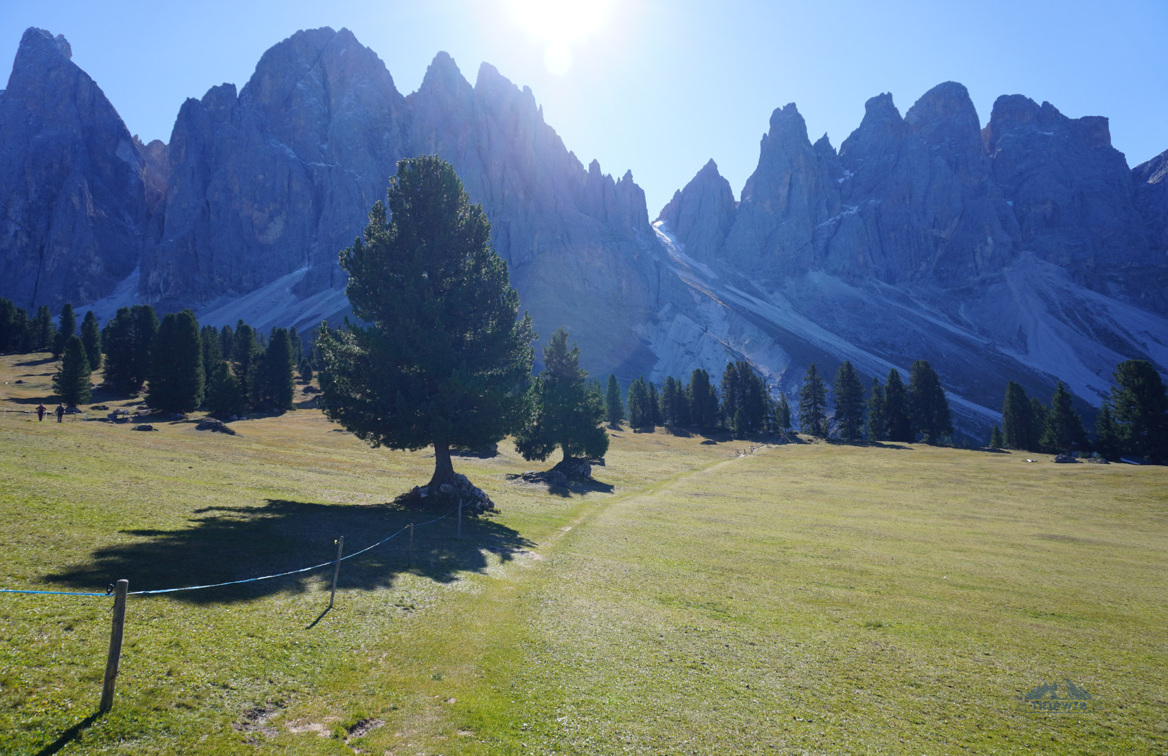
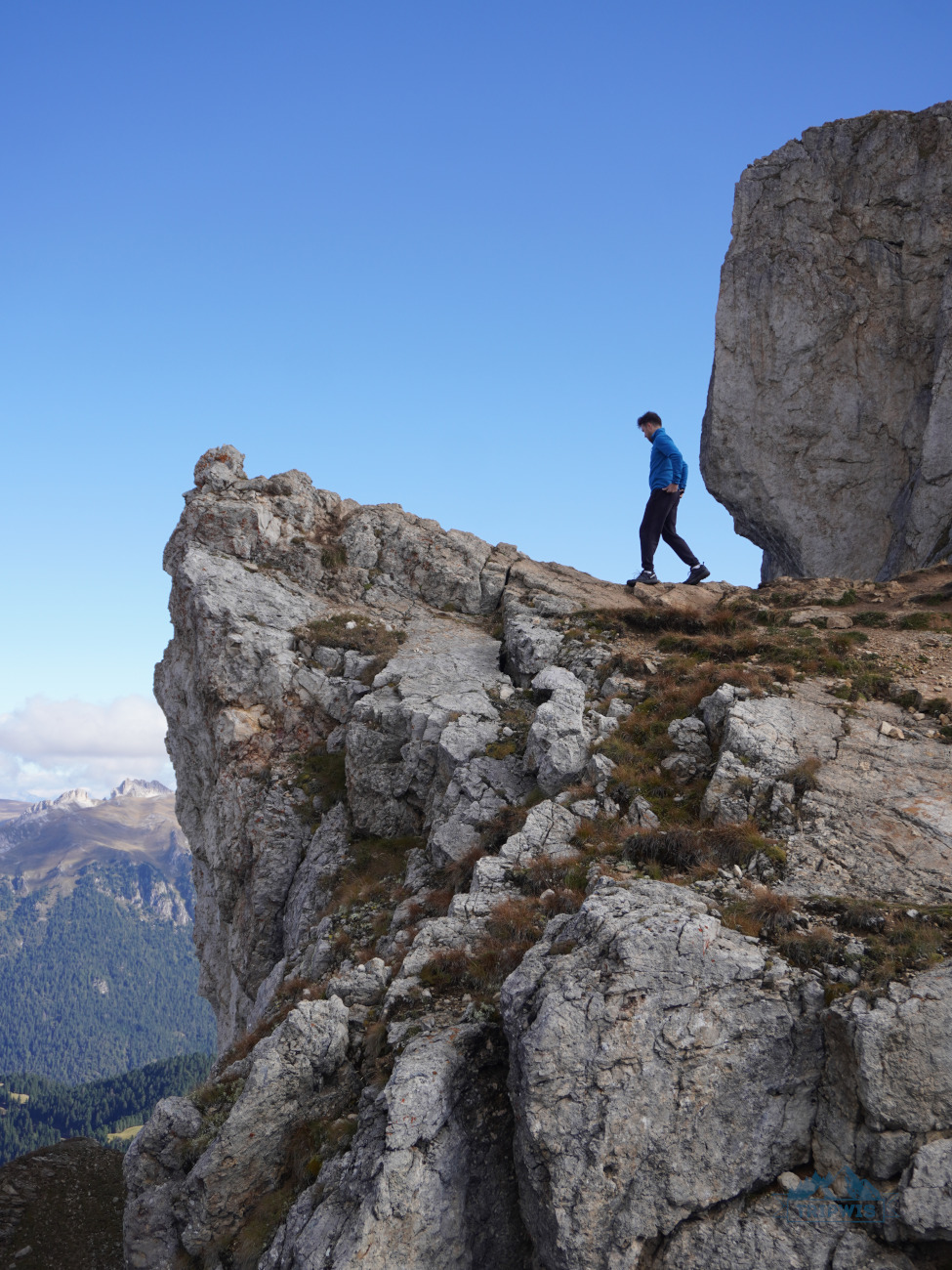
Adolf Munkel trail is basically a collection of various viewpoints of the same spectacular sight – the Odle / Geisler Mountains. Sass Rigais (3,025 meters) and La Furchёta (3,025 meters) are the most prominent peaks of the group, with the Fermeda subdivision (around 2,800 meters) adding the sturdy drama, and Seceda (2,519 meters) providing a surprising perspective.
Since we were doing the hike on our fifth day in the Dolomites, we were already quite familiar with the scene. However, what we didn’t expect was to see Seceda so clearly – we could catch glimpses of people at the ridgeline, and even make out the top of the cable car station. If you’ve done the Seceda hike already, you would be pleased to find yourself on “the other side” of the mountains!
Now, let’s take a closer look at what you can expect to see when setting off on the legendary Adolf Munkel trail under the Geisler peaks.
You start from Zanser Alm / Malga Zannes.
 |
 |
Since Adolf Munkel is a loop trail, you can start off in either direction. However, I encourage you to go with the flow of the crowd by embarking on the path clockwise.
Side note: Remember that if you’re short on time, you can condense your experience into a Geisler Alm out & back hike. In this case, you would want to begin your journey counterclockwise.
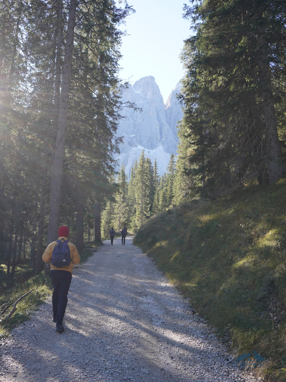
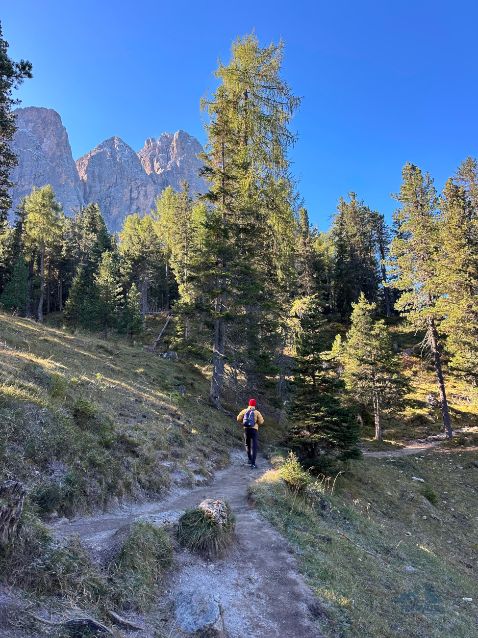
As you commence on your journey, you will be walking on trail no. 6. The elevation gain is very lowkey; you’re not even sweating yet at this point. The path starts off as a paved road, but after the rifugio, it turns into a gravel trail that is slowly getting enveloped by the forest. Thick pine tree branches crowd your peripheral vision, and an occasional root system sticking out of the earth creates an obstacle to a carefree hiking experience.
Thankfully, there’s not much to look at yet – the beginning of the trail is pretty boring. Patience, young grasshopper!
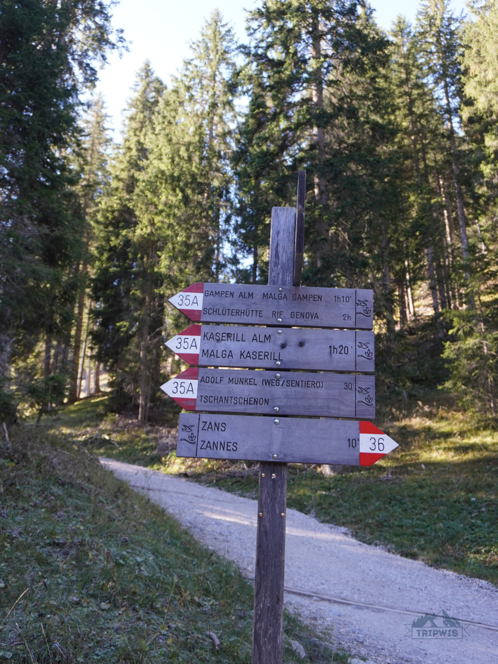
The forested stretch of the path runs for quite some time with little to no interruptions; there’s only the swishing sound of the branches. Then, suddenly, you come upon a stone bridge; after you cross it, you are met with a wooden turnstile that officially signifies the beginning of the Adolf Munkel trail for you (you’re now on trail no. 35).
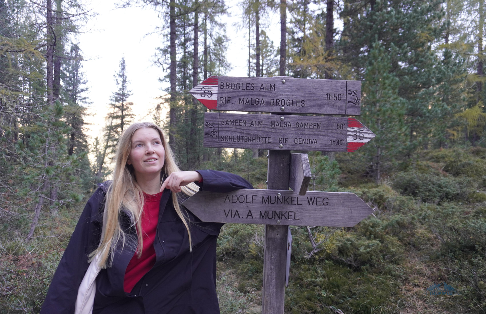
The next crossroads is where you turn onto trail no. 36 towards Geisler Alm. You will realize that that’s where you’re meant to change trails by the scene itself – the fork in the road appears at the foot of a wooden staircase.
After a short stop to view the mountain tops, it’s time to conquer the steepest part of the climb – the path narrows quite a bit, loose rocks appear, and tree roots begin to pose a real problem. The “climb” is very doable and very short – you will break a sweat, but not soak through completely.
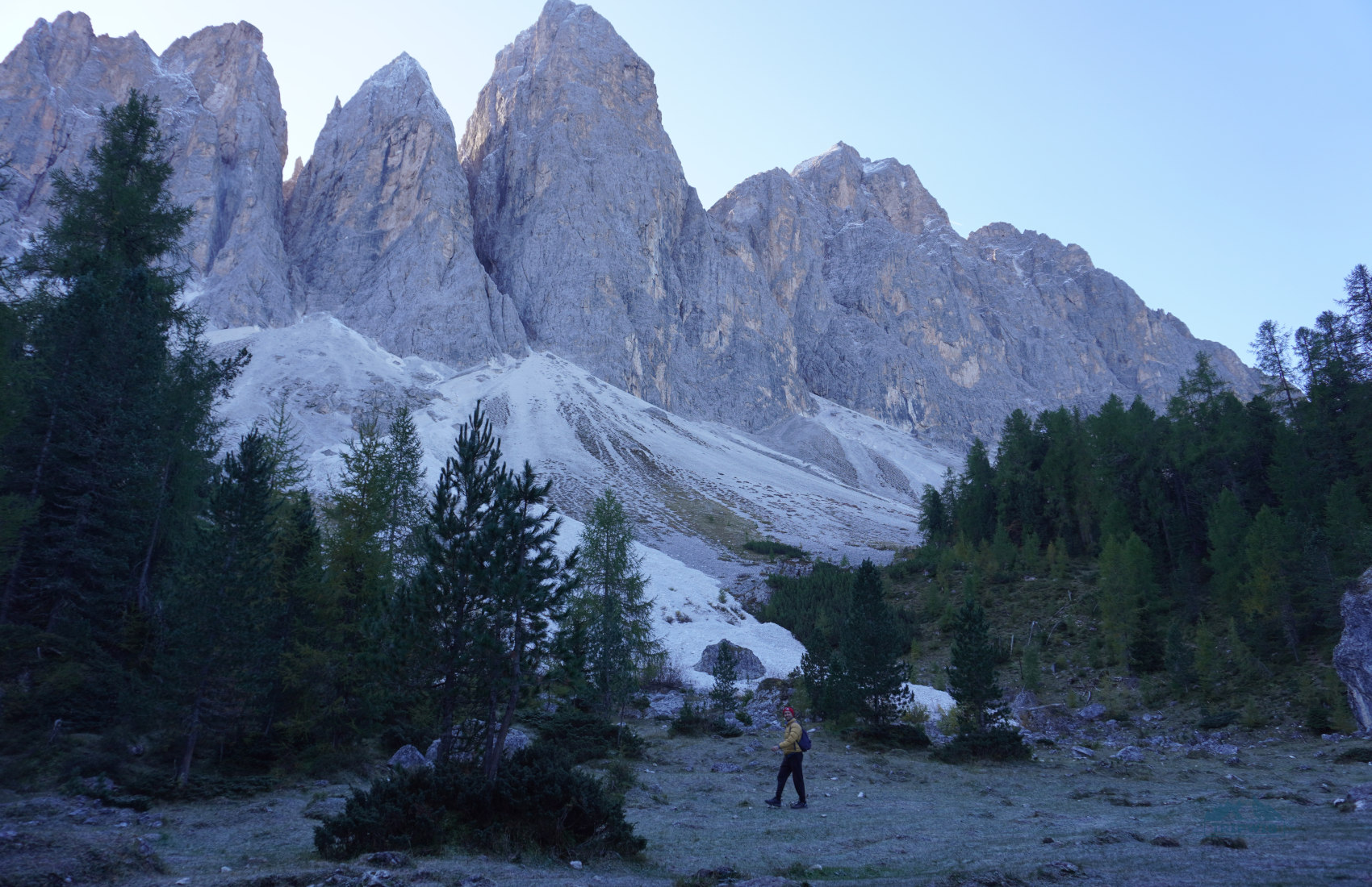
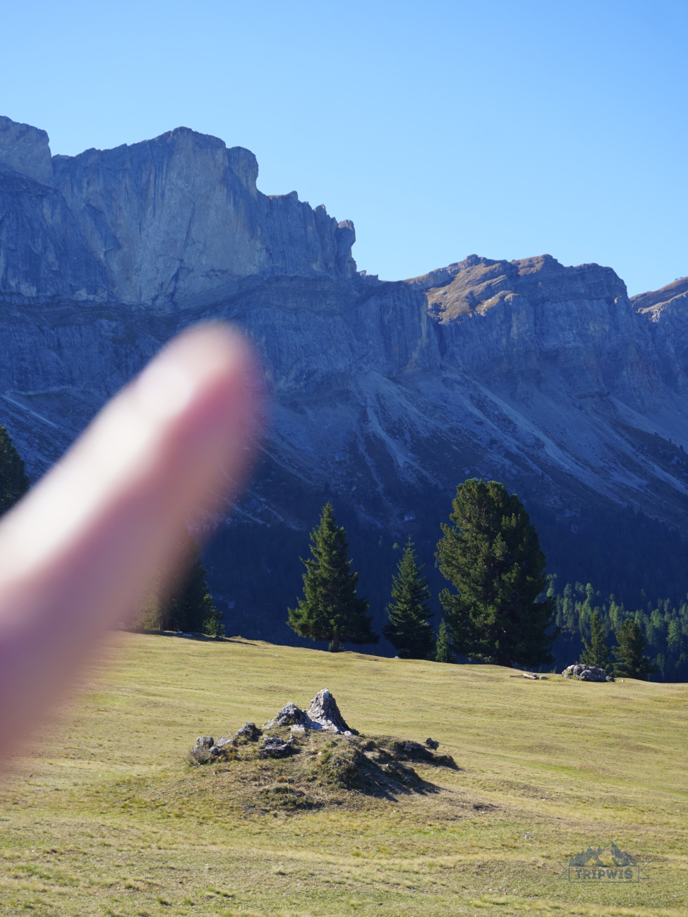
As you continue the hike, you will soon stumble upon a spectacular sight – you will find yourself at the edge of the trees, right at the base of the mountains! We were awe-stricken to be so close – even when we hiked around Tre Cime di Lavaredo, we never were quite as near to the base of the peaks. The tall granite formations that look like they are punching the sky will take your breath away; and their more solid lower slopes might confuse you – it looks like the foothills are covered in snow, when in reality these are scree fields of white small rocks that you’re witnessing!
As you continue to hike alongside the slopes, know that a sudden change in scenery is coming soon – after an hour and a half from starting the adventure, you finally turn your back to the mountains and welcome a rolling green meadow full of lone fir trees and picturesque rifugio.
Your first rifugio is Malga Casanago / Gschnagenhardt Alm (open only in summer; from the end of May till the end of October)
 |
 |
There are three rifugios in the valley, and Malga Casanago is the first mountain hut that greets you on your hike through the meadow, making it an important stop on your trail itinerary. Gschnagenhardt Alm is a family-owned hut; the Profanter family has made it their mission to offer their guests the opportunity to rest and recharge, with great views and delectable South Tyrolean cuisine to boot.
At this point, it becomes apparent that there are two downsides to hiking the Adolf Munkel trail in the clockwise direction.
- First, as you cross the meadow, the iconic mountain peaks are behind you, which makes it hard to take them all in while walking.
- And second, if you start off on the hike in the morning (following our example; we were on the trail bright and early), by the time you reach the first rifugio, the sun is directly behind the mountains, creating unfavorable lighting conditions that are not synonymous with great photos.
Of course, both of the downsides can be worked with: You don’t really have to constantly stop and turn around to witness the peaks, you can allot quite a bit of time for enjoying the panoramas at the viewpoint at Geisler Alm. Plus, if you’re hard set on getting National Geographic worthy pictures, you can just start the hike later in the afternoon and catch that legendary Alpenglow slowly make its way across the peaks at sundown.
Personally, we paused for just a moment at Gschnagenhardt Alm as Rifugio Odle with its viewpoint is so close you can almost touch it, so a full-on stop wasn’t in our plans. Still, the mountain views that open up from Gschnagenhardt Alm are already jaw-dropping; so you might want to stay here a little bit longer and take it all in.
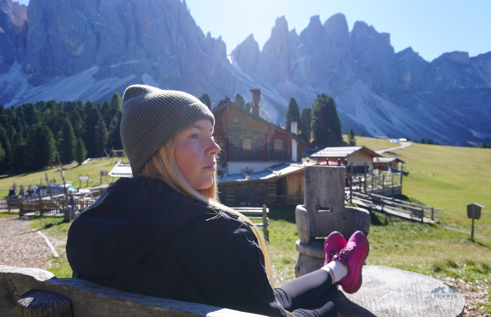
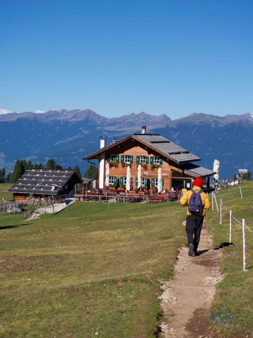
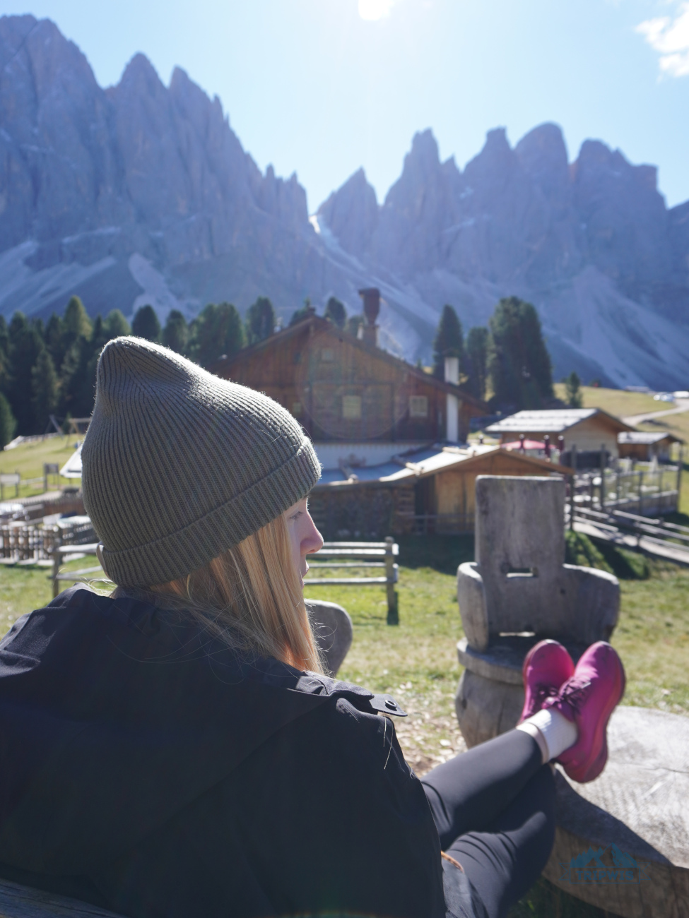
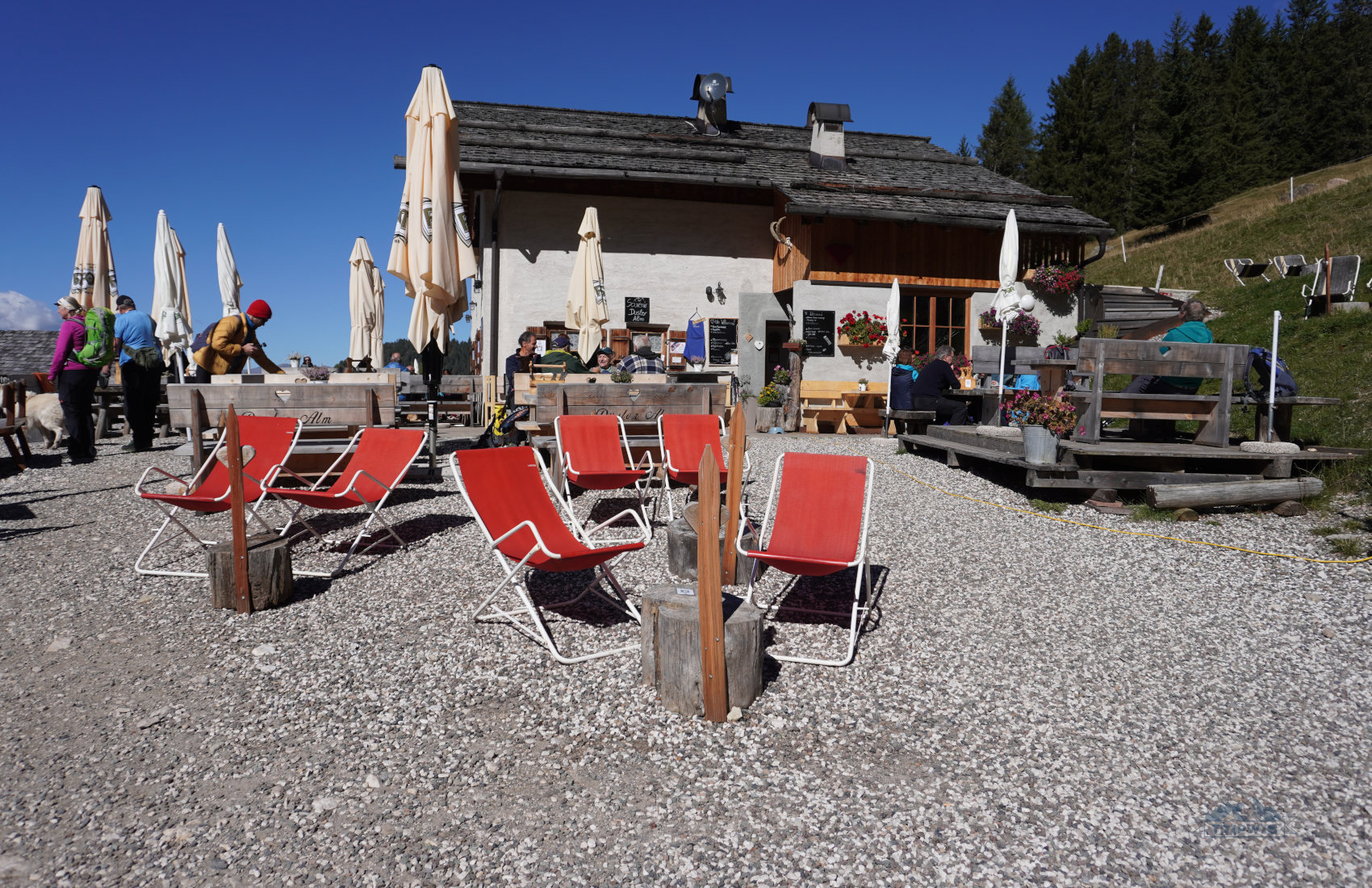
Your next stop is Rifugio Odle / Geisler Alm (open almost year-round; summer season is from May 23 till November 2; winter season is from December 26 until March 16)
The mountain hut by the name of Rifugio Odle is the crème de la crème location of the Adolf Munkel loop trail. Even in October, the rifugio was buzzing with visitors (though we hardly saw any people on the trail itself) – the dining area, both inside and outside, was crowded with hikers; the playground and the petting zoo were full of younglings burning off all the extra energy, and the viewpoint of the Geisler Peaks was packed with holidaymakers lounging about both on the grass and the wooden benches.
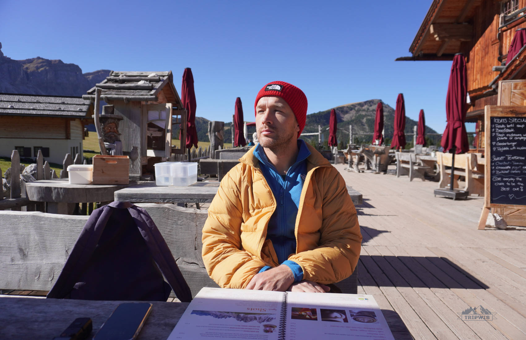
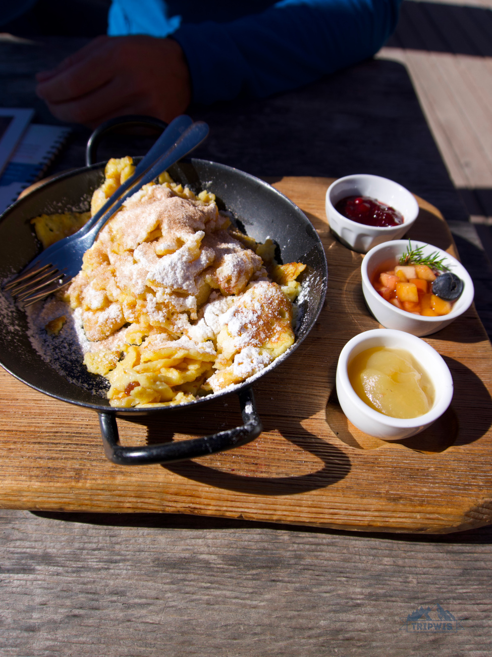
The focus of the rifugio restaurant is South Tyrolean classics. Personally, we came here to try the Kaiserschmarrn (€16) – also known as the “emperor’s mess”, it’s a thick fried pancake, served in torn chunks in a pan, covered with a substantial amount of powdered sugar; with jam on the side. If you don’t have much of a sweet tooth, you can get a full-on meal here.
The prices at Geisler Alm are understandably high – after all, you’re not just paying for the food, but also for the welcoming ambiance and kick-ass views!
- A fan-favorite goulash or a platter of spare ribs will set you back €24 on average; follow it with a homemade mulled wine (€7) or a cappuccino (€5). Geisler Alm coffee was the most expensive caffeinated drink we’ve had in any other rifugio in the Dolomites!
 |
 |
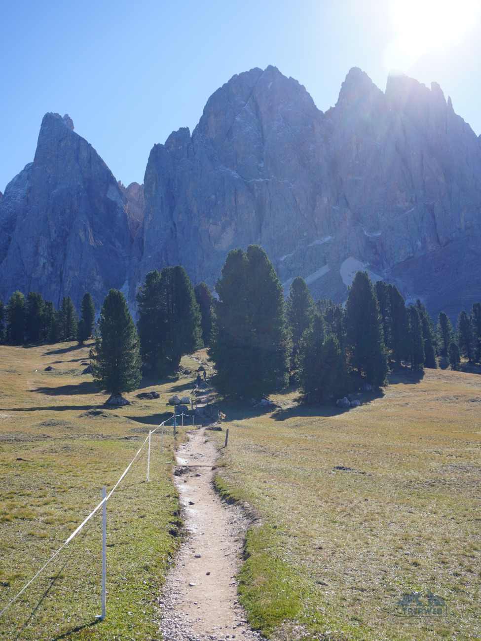
Speaking of the Geisler Peaks panoramas, after you’ve stuffed your bellies with some hearty dishes, it’s time to make your way towards the hillock set right behind the rifugio. This slightly elevated area is called Cinema delle Odle (Geislerkino), and it is one of the best viewpoints of the Adolf Munkel trail – the drama of the Geisler / Odle group is right there in front of you, in all its breathtaking glory!
It also helps that the area is fitted with large wooden benches and even recliner-looking seats; both amazing for kicking back, relaxing, and staring at the Geisler Peaks for as long as your heart desires.
Since Geisler Alm is set about 6 kilometers into the hike, it warrants a lengthy stop. However, the loop is not over yet, so it’s time to rejoin the trail no. 36 in the direction of yet another rifugio.
Dusler Alm / Malga Dusler (open only in summer; from the end of May till mid-October)
The rest of the trail runs mostly downhill, with the tree clusters growing more and more frequent. Dusler Alm is a rifugio that gives you a new take on the already familiar panorama – as you sit at the outdoor terrace of the hut, you’re witnessing the towering peaks being enveloped by the tall spruce trees below.
If you didn’t manage to snag a table at Rifugio Odle (it is the most popular rest stop of the trail), you can stop for a meal at Malga Dusler. However, it’s just a 40-minute hike back to the parking lot, where you can finally take a break at Zanser Alm without worrying of getting a stomachache from walking with a full belly.
As you finally emerge from the forest (Geisler Peaks not visible from the lot), the entire adventure seems to have a dream-like aftereffect. Mulling over “were those views real or not” will not get you anywhere, so I advise dropping your packs and celebrating another Dolomites hike well done by grabbing a warm (or just warming) drink at Zanser Alm.
All in all, the entirety of the Adolf Munkel trail is guaranteed to leave only the best of the impressions on the hikers brave enough to conquer the 10-kilometer stretch – the difficulty of the route is invigorating enough to not be boring, the constantly changing scenes keep up the morale and curiosity, and the delicious local dishes at the rifugios bring about the feelings of comfort and ease. The sprawling meadows, the mighty peaks, the thick forest – the trails that were once trodden by Tyrolean royalty are now a fan-favorite destination in the beautiful Val di Funes!
Our 5-day Dolomites itinerary >>
When to hike the Adolf Munkel trail and other FAQs
What is the best time to hike the Adolf Munkel trail? Most guides lead you to believe that the entirety of the high season in the Dolomites is a good period for hiking the Adolf Munkel trail. It is true to some degree, but there are a few caveats to think about:
- Summer months are great for hiking the Adolf Munkel trail due to the weather – it rarely rains, and the high temps are still bearable due to the large section of the path running through the forest. However, high season brings crowds – you will not have the trail all to yourself, and the rifugios will be packed.
- Shoulder months (May, late September, early October) are perfect opportunities to hike the trail in relative isolation. Though you’re bound to run into people near mountain huts; the Dolomites aren’t as deserted in shoulder season as most sources will have you believe. However, you also run into the possibility of rifugios being closed and early frost on the path.
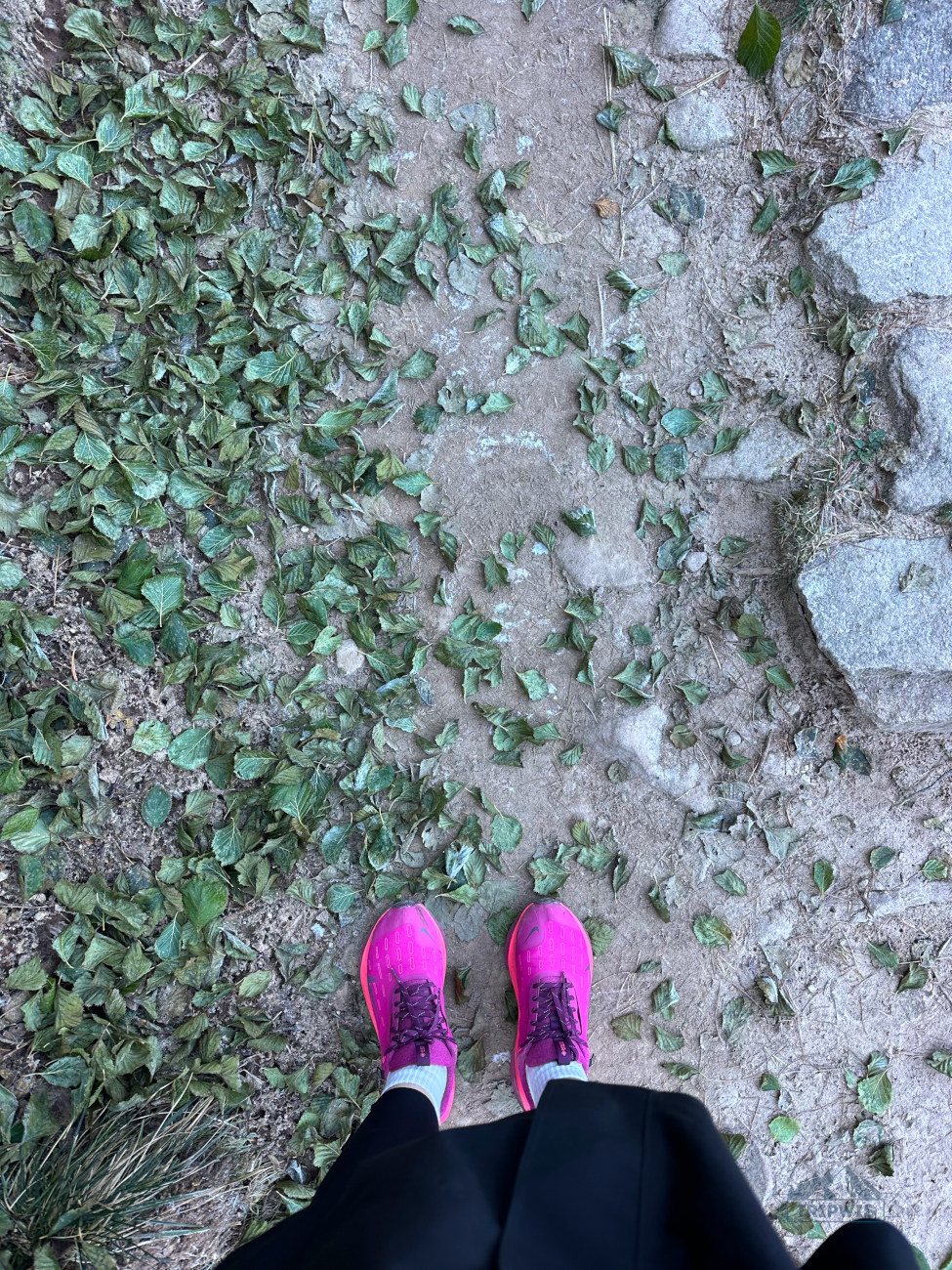
Our experience: When we hiked the Adolf Munkel trail at the beginning of October, there was already a thin layer of ice on the ground. Though it melted by midday, we had to be more careful of our steps.
- The trail stays operational in winter months, though it requires proper equipment (snowshoes, poles – the whole nine yards!).
From personal experience, early October seemed like a great time to be on the trail – the scenery was simply magical and we had a wonderful time!
When is Adolf Munkel snow-free? From mid-April through November.
 |
 |
What is the best time of day to hike Adolf Munkel? The trail is unique because you do not rely on the cable car openings to set the limits to your hike day (Alpe di Siusi and Seceda have this problem). Most travelers set off on the hike early in the morning (as we did as well) – it is a perfectly sensible decision, since there will be more free parking spots to choose from at the lot, and the trail will not have the chance to get too busy.
If taking wonderful pictures is very important to you, then you should start the hike well after midday (closer to 3 or 4 p.m.; around four hours before the sunset). However, in this case, you will have to rely on parking spot turnover – as the early trail birds start to leave, you will catch the opportunity to park at Zanser Alm.
Are there facilities on the trail? Yes, there are three rifugios in the valley and one by the trailhead. Mind the operating periods and opening times – only Geisler Alm and Zanser Alm stay open through some winter months as well; other mountain huts close for low season.
What else do they call this trail? You may also see this trail referred to online as Adolf Munkel trail to Geisler Alm or simply the Geisler Alm hike.
Is Adolf Munkel a family-friendly hike? I would say that it is! I saw plenty of groups with kids while hiking, and there were multiple gaggles of children going crazy at the Rifugio Odle playground. However, if your child is not particularly fond of walking for a prolonged stretch of time, then I would recommend shortening the hike to a Geisler Alm outing, in the counterclockwise direction from the trailhead.
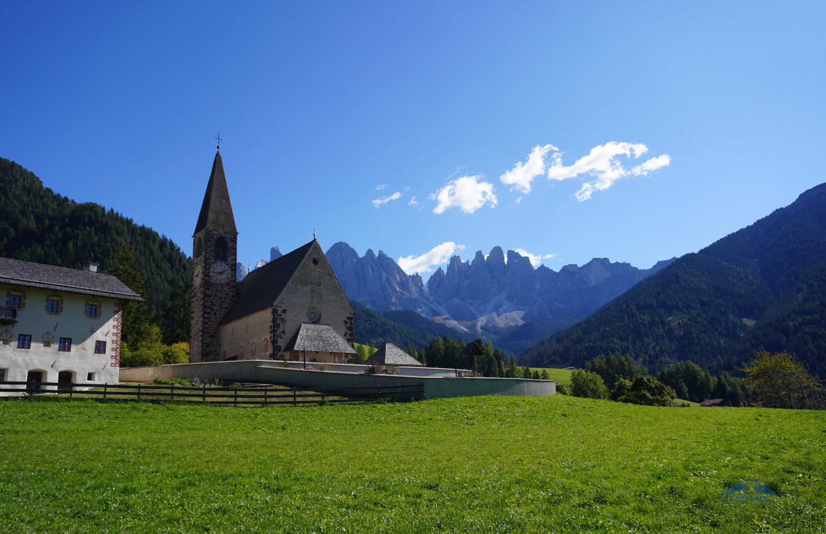
What are some other tourist attractions worth checking out in Val di Funes? Chiesa di Santa Maddalena in St. Magdalena is a picture-perfect little church that could even be visited as a substitute to the Adolf Munkel trail! Though it is set further away from the foothills of the Geisler mountain range, it still offers beautiful panoramas of the peaks. Named after St. Mary Magdalene (the first woman to witness the resurrection of Christ), it adds a prominent cultural significance to your outing.
Additional tips about the Dolomites
We figured that after going deep into our guide to hiking the Adolf Munkel trail in 2026, I could now focus on the tips that can be used for a larger Dolomites itinerary in general.
Car rental in the Dolomites
Renting a car in the Dolomites still remains the best choice you could make here. Driving a rental gives you the ultimate freedom of movement; you do not have to suffer the constraints of the bus schedules or train delays. However, using the car comes with added expenses and plenty of things to keep in mind: Parking costs ramp up fast in South Tyrol destinations, and you can’t always find a free spot to begin with!
Still, we like to be in charge of our own itinerary, so we went with a car rental. If you travel to the Dolomites, chances are your plane will land in either Milan, Venice, Verona, or right in Bolzano, the heart of the region. Picking up a car at the airport is a convenient process; particularly if you booked your four wheels well in advance.
- Personally, we used the services of Discovercars to rent a car in the Dolomites – we picked up a new Lancia Ypsilon at the Milan airport*.
*Both of these decisions were driven by the desire to save the budget, since the Italian fashion capital had the best deals on plane tickets and the shoulder season car price was an absolute steal – €80 for six days. But there are three other cities and airports set closer to the Dolomites.
Renting a car in the Dolomites is an easy process; however, it requires the traveler to have a few things in mind:
✔️The legal driving age is 18 in Italy, though most rental agencies require the driver to be at least 21 (or 25) years old.
✔️Even though the rental agencies may not ask for it, having an IDP (International Driving Permit) on top of the valid driver’s license is required by law in Italy for non-EU tourists.
✔️I would highly suggest renting a car for your Dolomites adventures well in advance; I’m talking weeks and even months, especially if your trip falls on summer season.
✔️Make sure that you choose the full coverage option for your insurance; you don’t want to be financially set back because of a small rock going rogue on a mountain road as you’re driving!
✔️Renting a compact car is the best decision here, since most of the parking spaces are very small, and the mountain roads are narrow. Maneuvering a large car will be tricky.
✔️Plus, filling up on gas in bigger cities is essential; there aren’t many gas stations in high-altitude area.
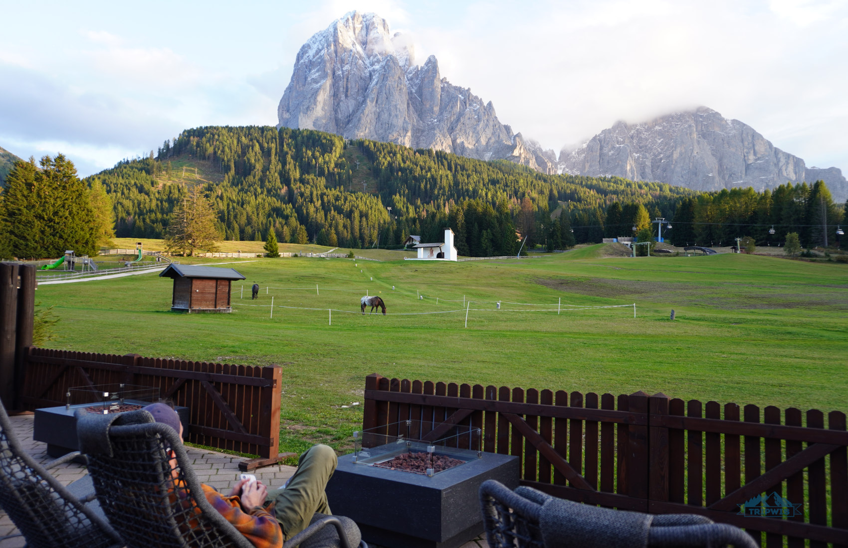
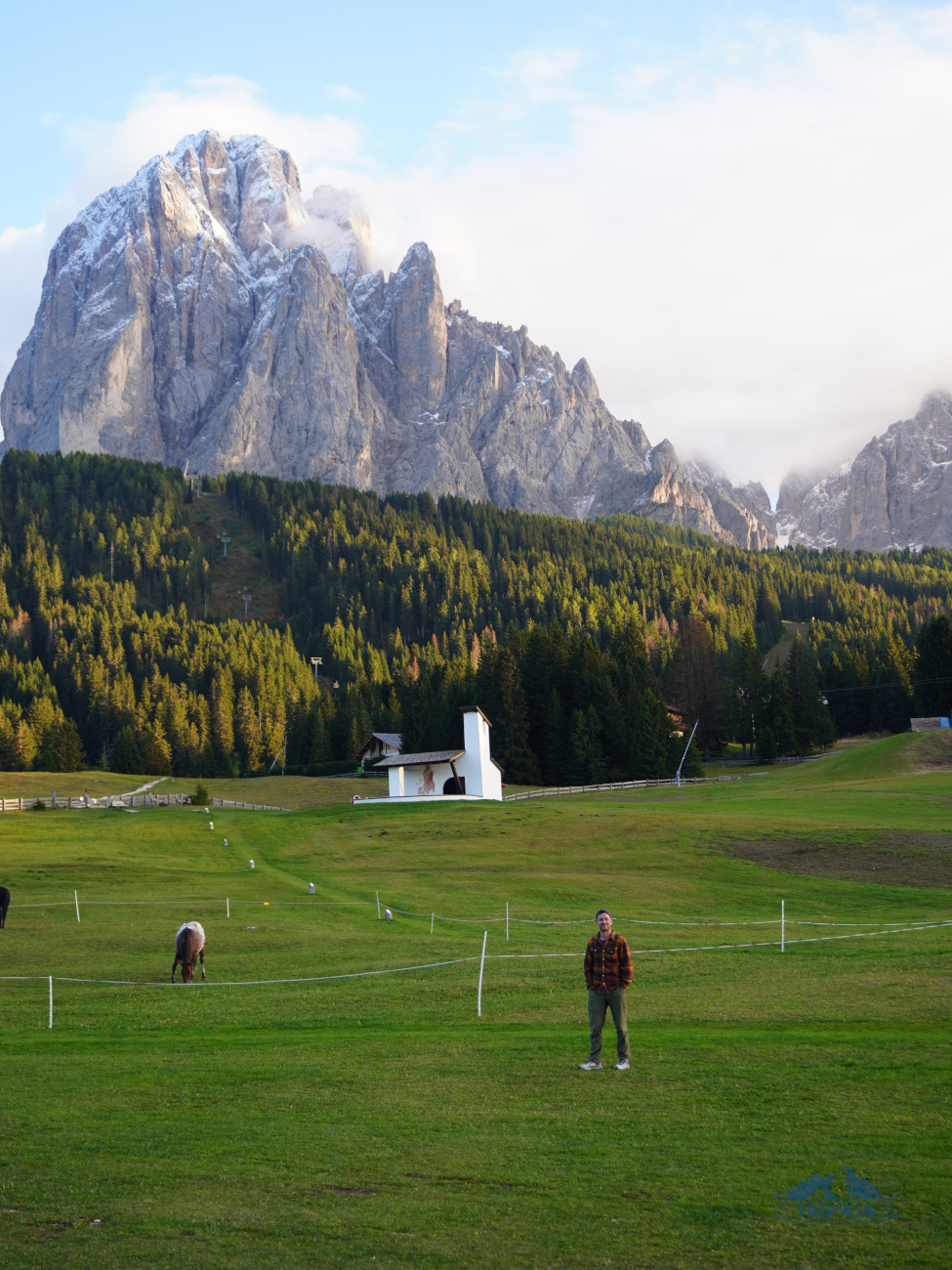
Where to stay in the Dolomites?
 |
 |
Gorgeous views from Monte Pana Hotel‘s terrace
If you rent a car in the Dolomites, you can stay pretty much anywhere you like in the region. Our South Tyrolean favorites boil down to these two accommodations:
- 4* Monte Pana Dolomites Hotel (Santa Cristina / Ortisei; from €200 a night) – a perfect base for exploring Alpe di Siusi and Seceda; the alpine-style design, views of Sassolungo from the backyard, exceptional breakfasts, and free on-site parking add to the overall Monte Pana allure!
- 3* Best Western Hotel Nevada (San Vito di Cadore; from €100 a night) – set close to Cortina d’Ampezzo, this hotel is a great getaway into your Lake Sorapis and Tre Cime di Lavaredo adventures.
 |
 |
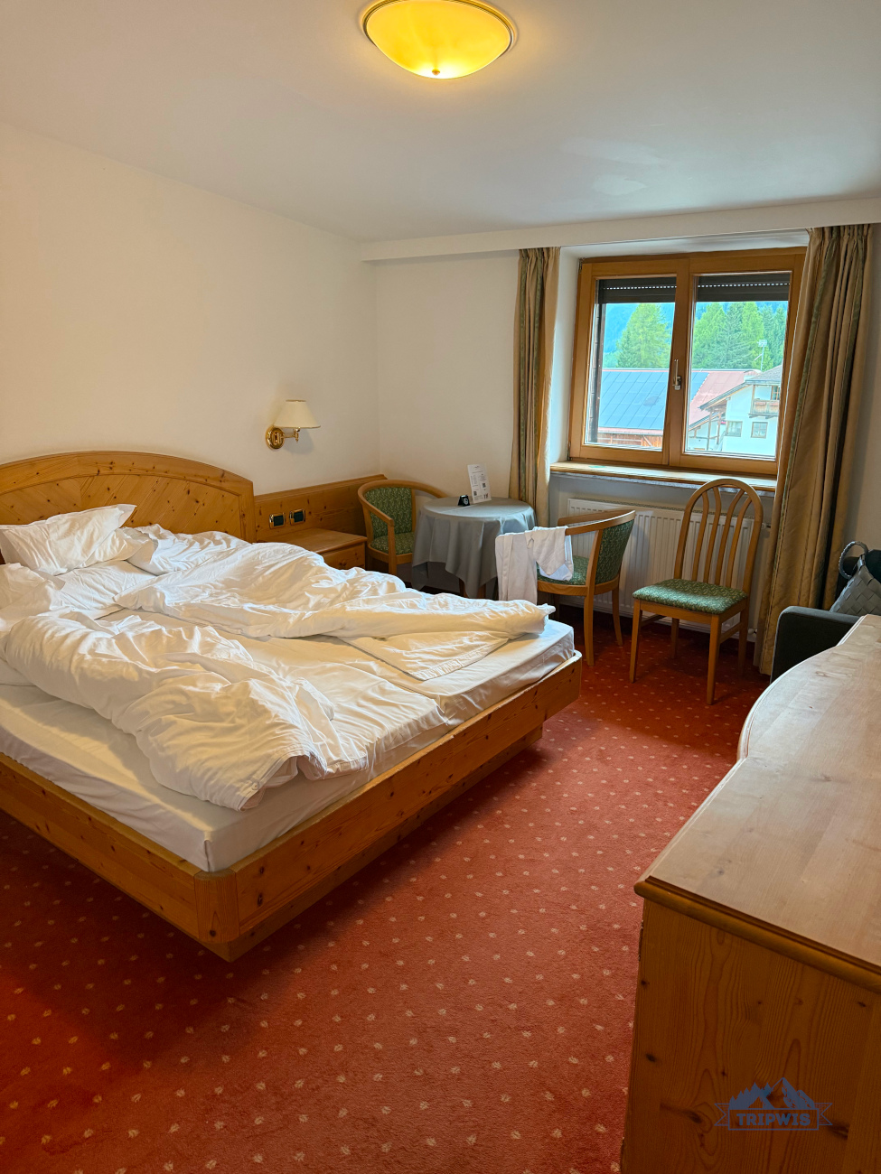
And this is the area around Gasthaus Zum Weissen Kreuz
However, if you want to set off on your hikes bright and early, it makes sense to stay closer to the trailhead. For Adolf Munkel, it means finding a hotel in Val di Funes. Here are a few recommendations you can look into:
- We stayed at: 3* Gasthaus Zum Weissen Kreuz (Lazfons; from €120 per night) – located near the edge of Val di Funes, this dreamy guesthouse was our pick for hiking the Adolf Munkel trail. It took us 40 minutes by car to get to the trailhead.
- 3* Hotel Walther v.d. Vogelweide Superior (Chiusa; from €200 per night) – a lovely hotel with its own restaurant and a really handy location: Both Ortisei and the Adolf Munkel trail are about a 30-minute drive away.
- 4* Hotel Tyrol (St. Magdalena; from €285 per night) – a chic sustainable hotel with amazing mountain views. An outdoor pool and spa facilities (sauna, hammam) will help you relax after a day spent hiking in summer or hitting the slopes in winter.
- 3* Hotel Fines (St. Magdalena; from €140 per night) – together with a highly regarded on-site restaurant, this hotel offers a well-rounded stay experience. It’s a small, family-run operation, so expect to be waited on hand and foot!
- 3* Raschotzhof (St. Peter; from €150 a night) – a budget-friendly stay in Val di Funes, right above St. Magdalena.
What is the most beautiful hike in the Dolomites that we did?
 |
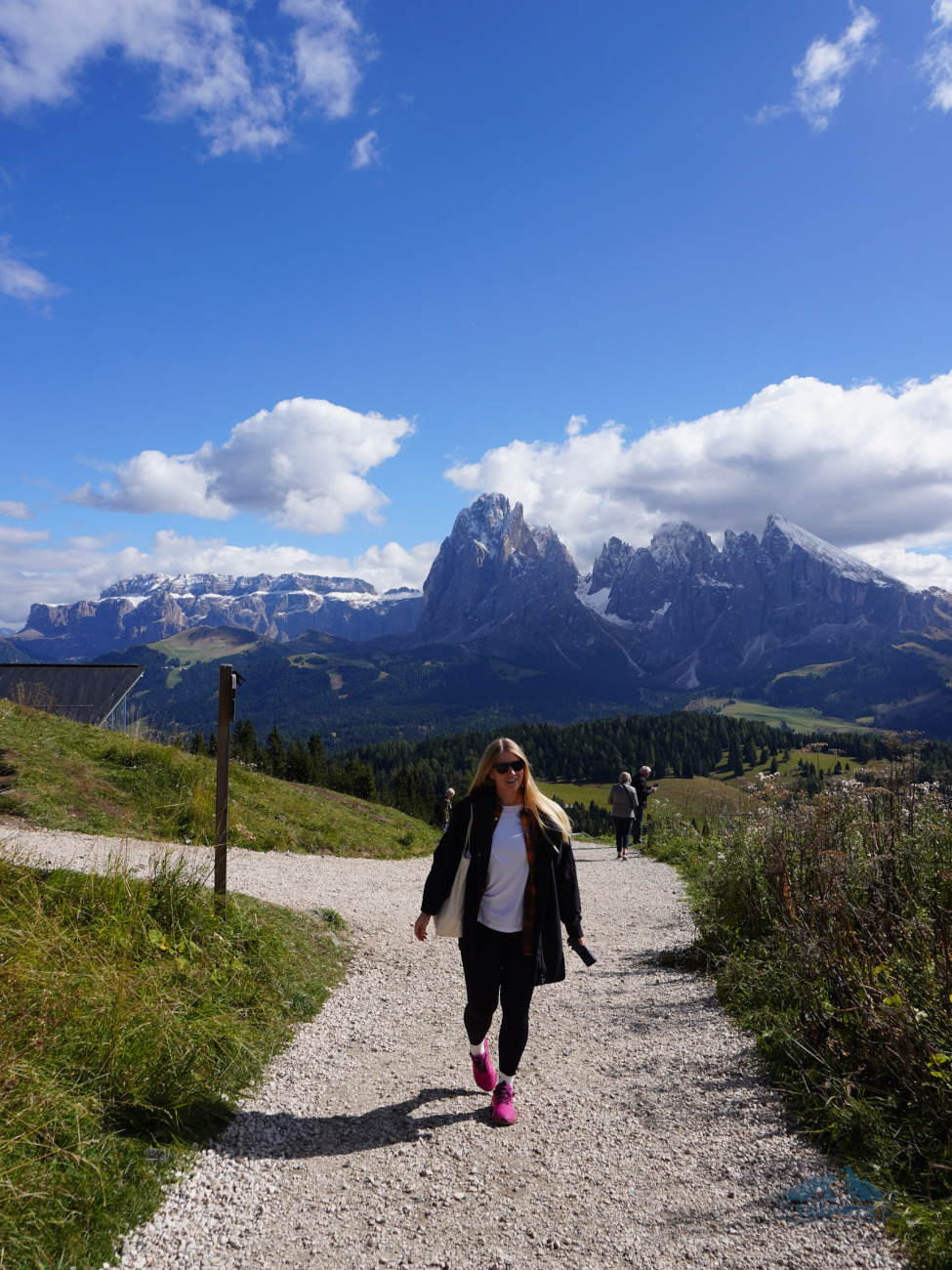 |
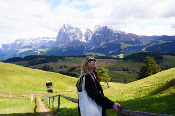
Seceda / Alpe di Siusi
It is so hard to pick a favorite hike in the Dolomites! While creating these guides, I kept changing my choice from Lake Sorapis, to Seceda, to Alpe di Siusi… The truth is, every natural location in the region will have you awestruck and stunned from the beauty of the scenery. You have to see it all to make an informed decision!
- Alpe di Siusi – a perfect introduction into the beauty of South Tyrol’s most prominent scenes; a short loop trail on the highest alpine plateau will have you ooh and aah from the beauty of the rolling meadow, the sharp peaks crowning the green bowl, and the dreamy huts peppered throughout the entire setting.
- Seceda – an iconic needle-like ridgeline that can be experienced in full with a hike from Col Raiser cable car (as opposed to the boring quick detour from Seceda cableways).
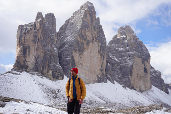
- Lake Sorapis – the destination you have to work for; the legendary milky blue lake can only be reached on foot via a pretty strenuous (and even dangerous at times) hike.
- Tre Cime di Lavaredo – in my humble opinion, the most overrated hike in the Dolomites. Still, it offers a full survey of the world-renowned three peaks, and for that, I deem it a worthy outing!